Walker's Haute Route
The Walker’s
Haute Route
Walker's Haute Route
The Walker’s
Haute Route
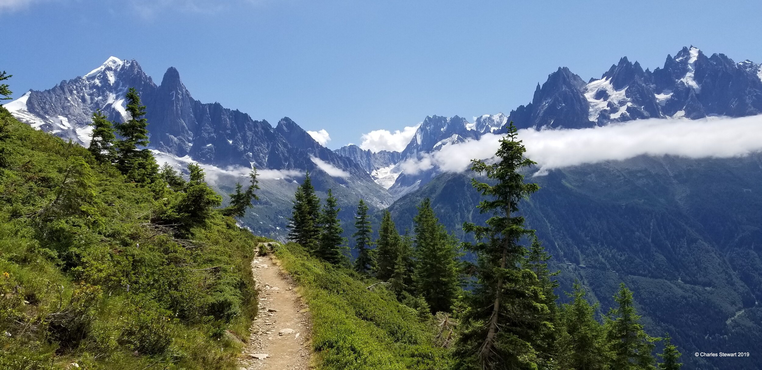
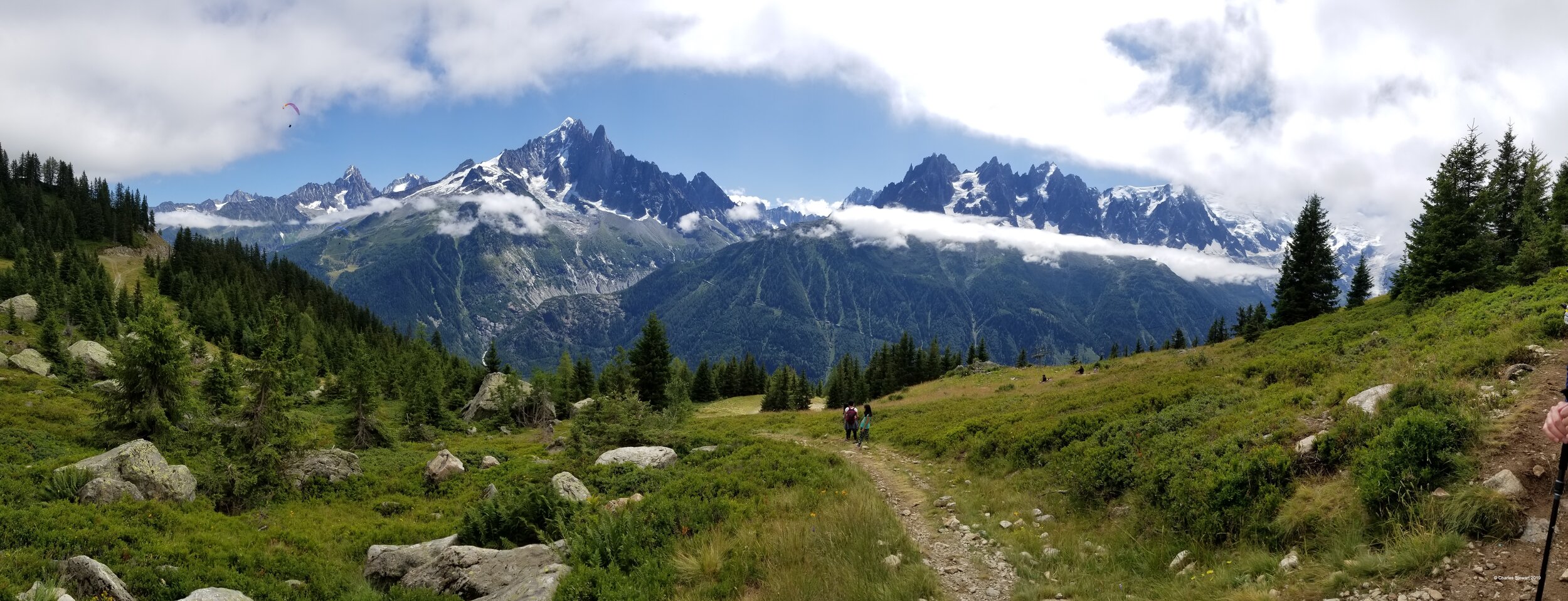
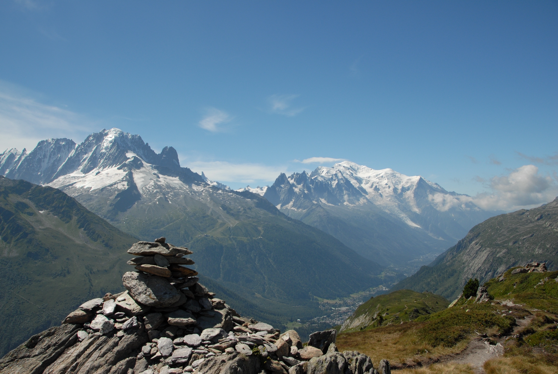
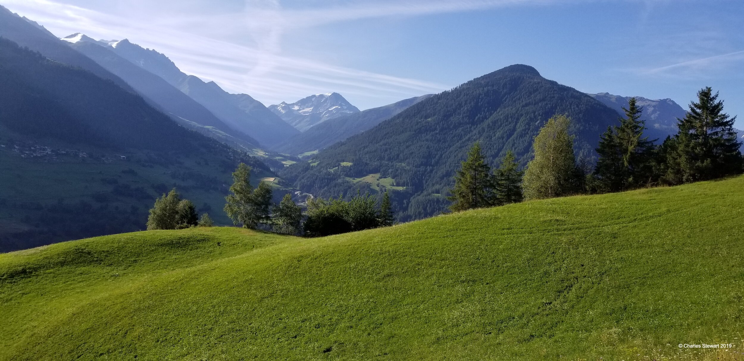
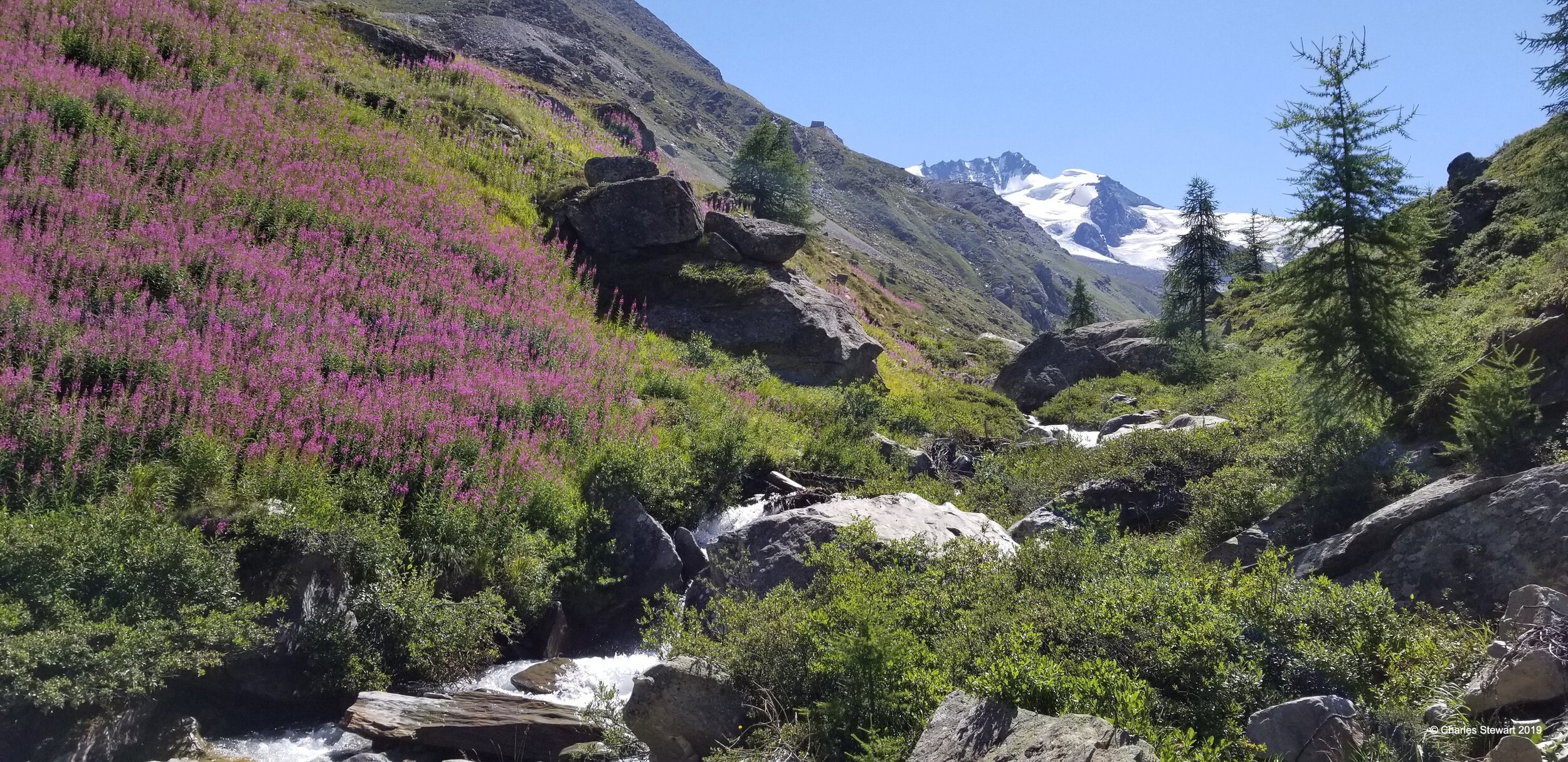
Grand Balcon Sud above Chamonix
Because of the uncertainly of Covid-19 in Europe and the window required to book this trip, we had to cancel the 2020 and the 2021 Haute Route trips. We are now taking reservations for the 2022 hike and already we have filled half the available spots. If you have an interest in this great trip and would like to make sure you get a spot in 2022, please reach out to us now. This hike, as usual, is limited to 8 hikers.
-Charlie
Walker’s Haute Route 2022
July 24, 2022- August 9, 2022
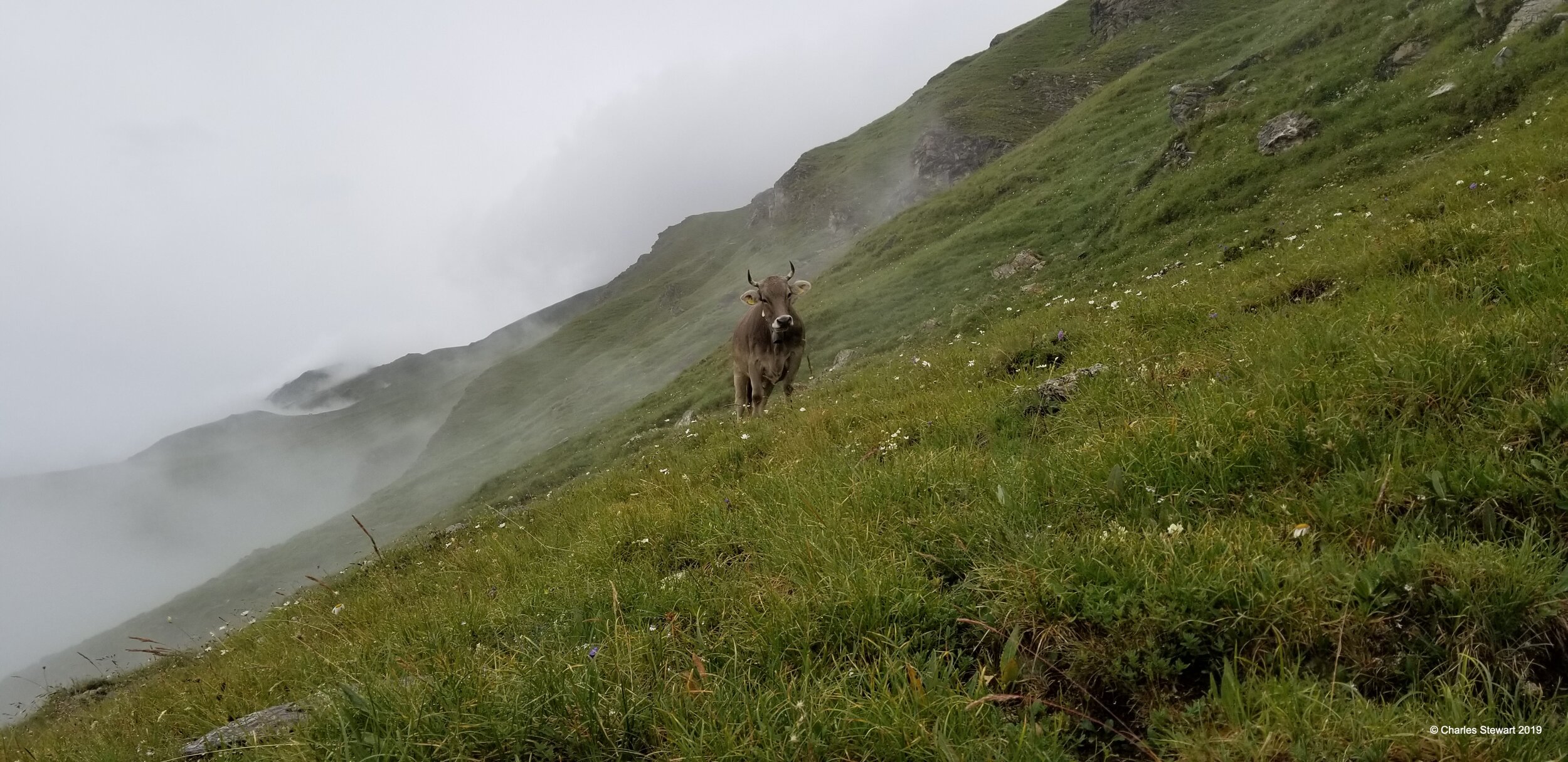
We hike the classic “Walker’s Haute Route” from Chamonix, France in the Mont Blanc valley, to Zermatt Switzerland at the base of the Matterhorn. This is the ultimate European hike and should be on every hiker’s bucket list. The hike offers fabulous views with terrain that varies from rolling green high mountain meadow (alp) to other worldly landscapes of rock and ice. Some days we walk beside bisse (open mountain fresh water aqueducts) and other days we find ourselves traversing a 1000 meter scree slope.
For 2022we hope to offer this trip for an all inclusive price of $6,000.00 again which includes air fare from Boston to Geneva, the scenic train ride on the classic Mont Blanc Express to Chamonix, 15 nights of lodging in a mix of hotels, mountain huts (cabanes), and auberges, all breakfasts and dinners, expert guiding, return train from Zermatt to Zurich and return flight from Zurich to Boston. Final price will be determined this winter as travel restrictions begin to settle down.
While we never climb above 3,000 meters, this trip requires a great deal of physical fitness and stamina. This hike has no rock climbing and requires no technical skills, however over the course of two weeks, we hike approximately 170 miles and climb a total of 50,000 feet. A typical day is about 9 miles in length and 3000 feet of elevation gain, although some days may be longer or more difficult. To prepare for our hike, all hikers participate in a few training hikes together which are included in the fixed price of this hike.
Price is based on double occupancy. What is not included in our trip are daily lunches and snacks (hikers often grab some extras at breakfast to munch on during the day), alcohol at meals where available, and travel insurance. Please see the FAQ below for other questions.
We must limit this trip to 7 participants. A $500.00 deposit holds your place. SIGN UP NOW
Please scroll to the bottom for photos from previous trips

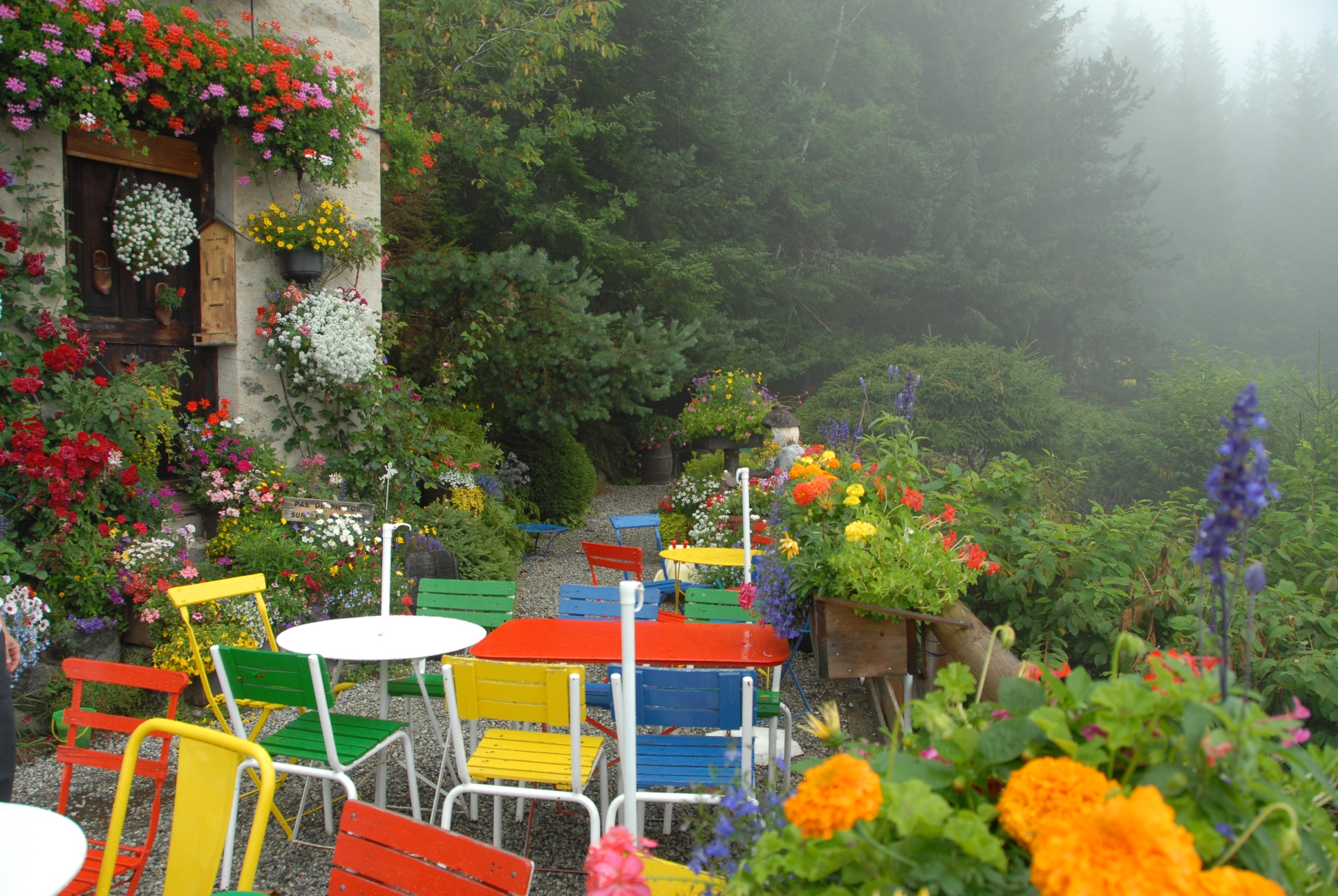
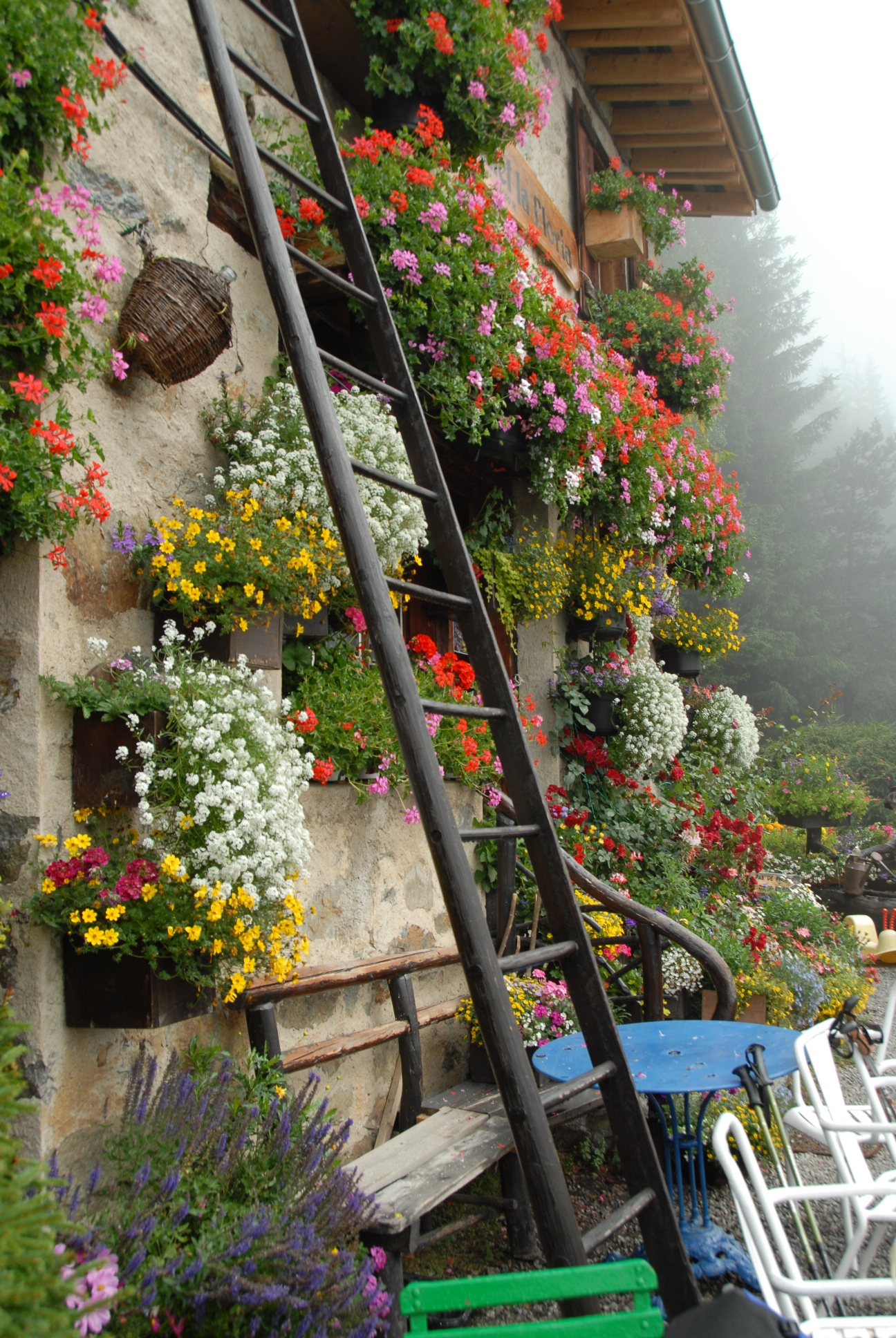
Flowers at Cafe La Floria on the first stage

On the path to La Chable

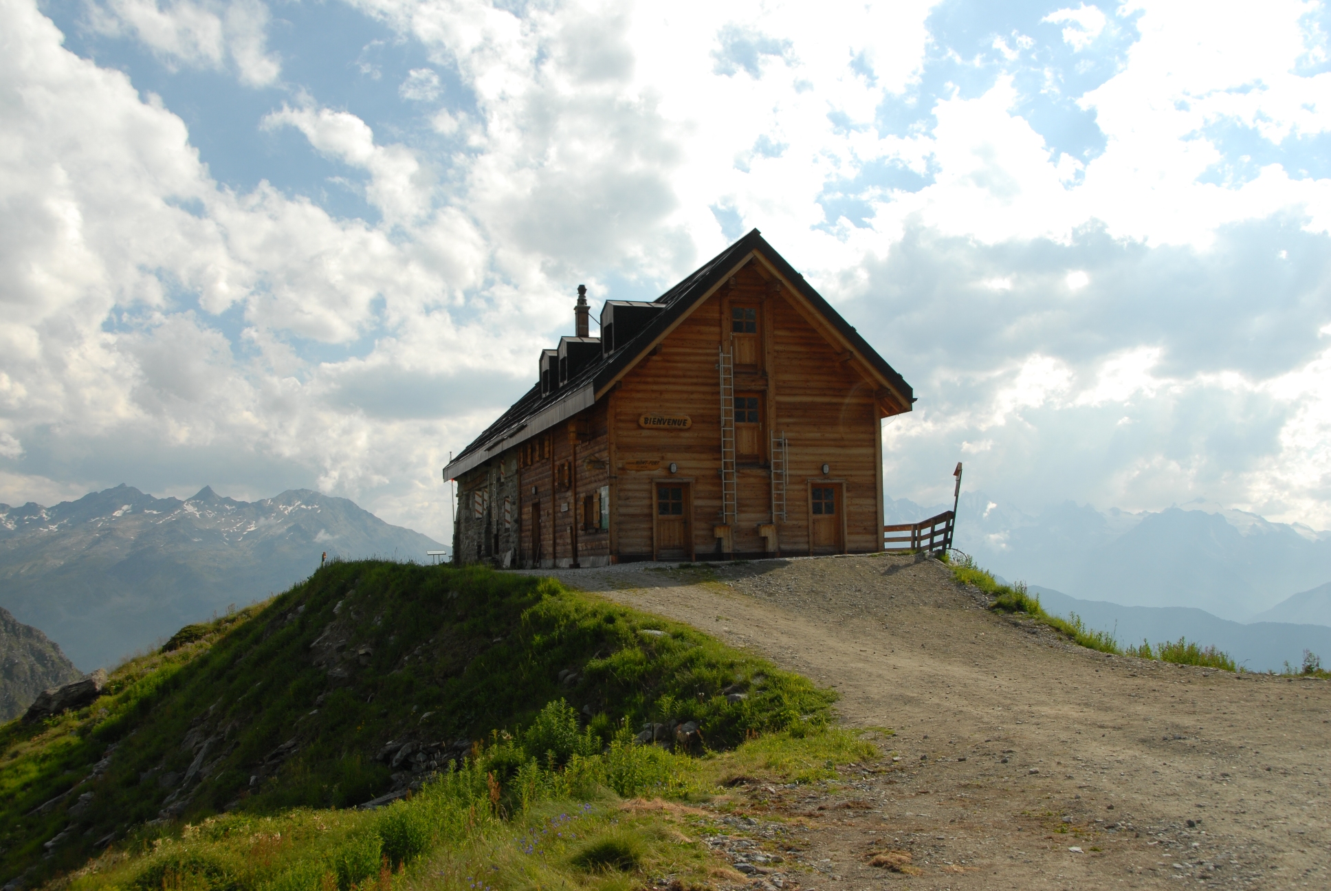
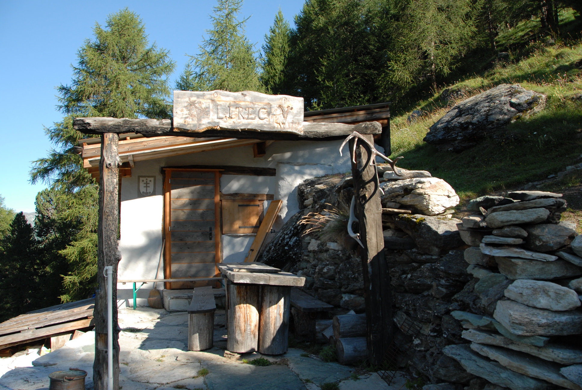
Cabane La Dix
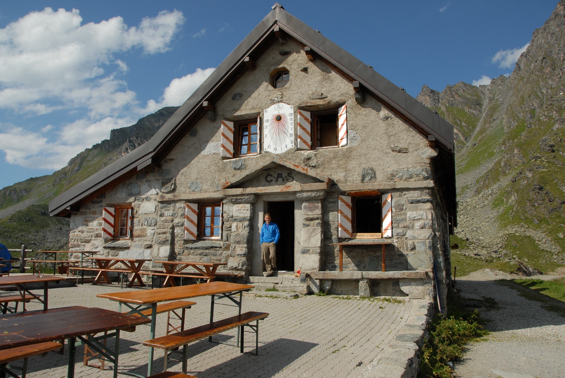
Cabane de Mont Fort
Frequently asked Questions
OVERVIEW
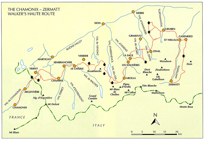
The Walker's Haute Route is a walking trail through the French and Swiss Alps that is about 170 miles in length and goes from Chamonix, France in the West to Zermatt, Switzerland in the East.
The highest point reached by the standard route is 2,987m (9,799ft) and the total height gain on the route is around 15,200m (49,867ft).
The hike takes 14 days to complete, so our hike is 14days and 15 nights.
FAVORITE SECTIONS
What hikers say...
We asked our Haute Route clients which stages they enjoyed most. Many love the thrilling finale on the Europaweg, being the last two days into Zermatt, but also popular are the days to Champex via the Fenetre d'Arpette, a high rocky pass, and to Cabane de Moiry with its stiff climb into the mountains.
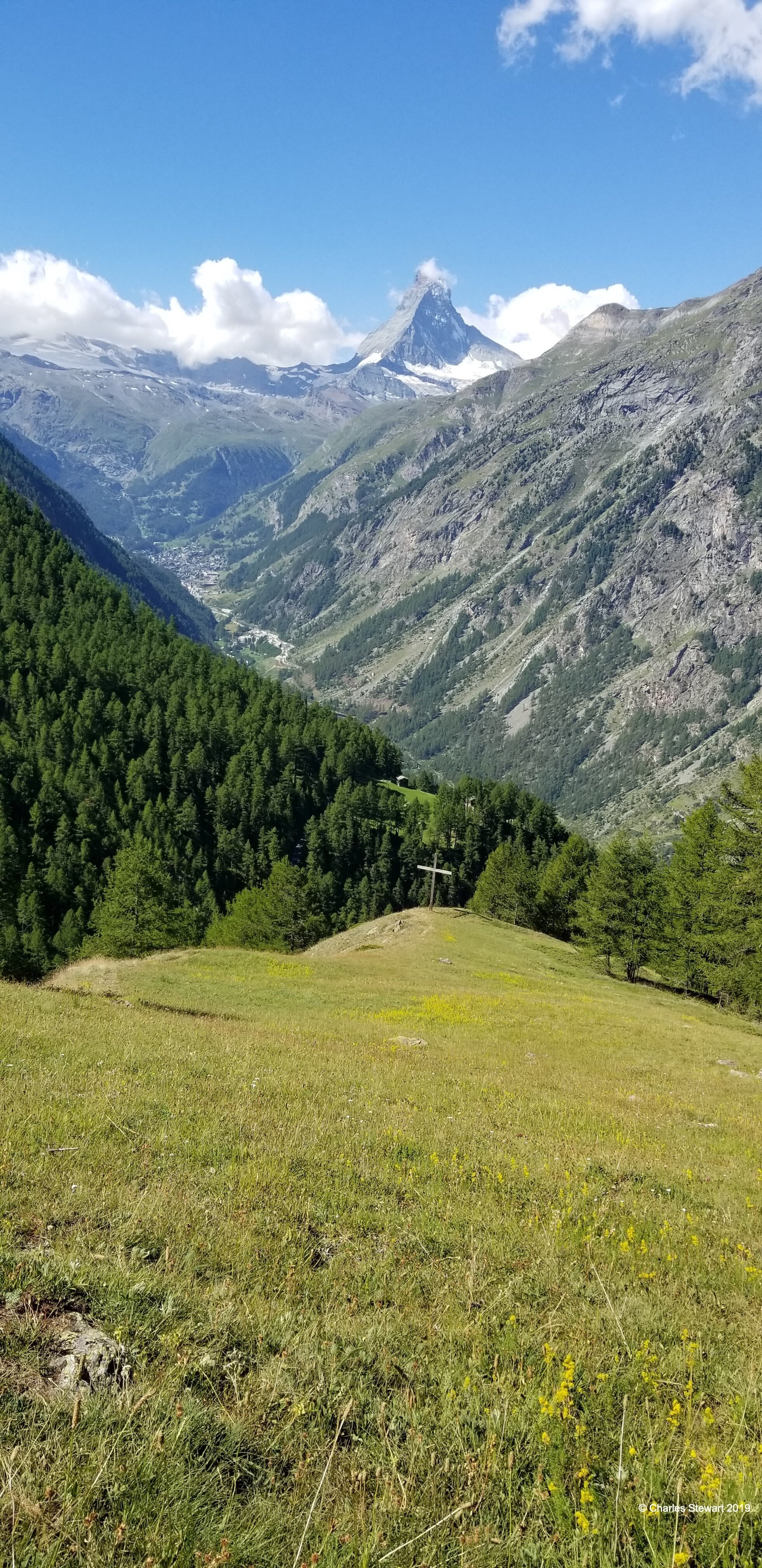
With good weather the Europaweg section allows the perfect view down into Zermatt, and up to the Matterhorn, as you traverse the rocky hillsides high above the Mattertal.
Other highlights
Other stages on the Haute Route have their own attractions. The three-day crossing from Le Chable to Arolla is perhaps the toughest but the most rewarding section of the whole route. The more remote sections are a true challenge even in clear weather.
The pastoral sections have their own charm, giving a glimpse of everyday life in rural Switzerland. These sections include the Champex to Le Chable stage, and the alternative valley stage into Zermatt that can replace the Europaweg if sections of the Europaweg are closed for repair as they have recently been in the past few years.
IS THIS THE SAME AS THE “HIGH ROUTE”?
The Walker's Haute Route is the proper title, in order to distinguish this trek from the original winger mountaineering route from Chamonix to Zermatt which is best referred to as the Classic Haute Route. This Classic route is the ski or mountaineering route across glaciers, taking a line generally to the South of the Walker's Haute Route. The French term Haute Route simply means High Route, as indeed it is!
This is a more extensive trip that then Tour de Mont Blanc and should not be confused with it.
IS THIS HIKE FOR ME?
The joy of hiking the Haute Route
There is great satisfaction in completing stages of a long-distance trek, even more so when it's a famous one like the Haute Route. There might be times when the climb seems too much effort, or when you encounter bad weather; at such times the goal keeps you going. Equally there should be days when you feel all-powerful, tackling the mountain trails as if they were paths in the park!
One of the best feelings on the hike can be nearing the end of a stage, once you're well into the hike, knowing that you've ticked off another leg of the journey. At such points you also look forward to exploring another Swiss village in the evening when you arrive. Traveling in a self-sufficient manner through the culturally and linguistically diverse terrain of the Haute Route makes for a thoroughly enjoyable and satisfying trip.
IS IT TOO STRENUOUS FOR ME?
The Haute Route is manageable for the fittest of hikers who are capable of hiking between 6 to 8 ½ hours each day, or more, along a long-distance trail that goes up and over high altitude mountains each day. One tough stage for many trekkers is the 10.5 miles hike from Cabane de Prafleuri to Arolla. This involves a total ascent of 920m (3,018ft) to cross the Pas de Chevres at 2,855 m (9,366ft). Another tough stage can be the walk from Gasenried to the Europahutte along the Europaweg.
HOW DO YOU HELP ME PREPARE?
We have prepared 360 degree videos that can be found HERE to give you an idea of what each day is like. We have question and answer slide shows to discuss the trip, and then once you have signed up, we will have get-togethers to discuss equipment and logistics. Most importantly, to help prepare for this hike, our group will hike three training hikes which will help us to get to know one another and prepare us for the hike. Other hikes on your own of similar daily distance and climb will also be of help in preparing for this two week journey across the alps.
WHAT'S IT LIKE UNDERFOOT?
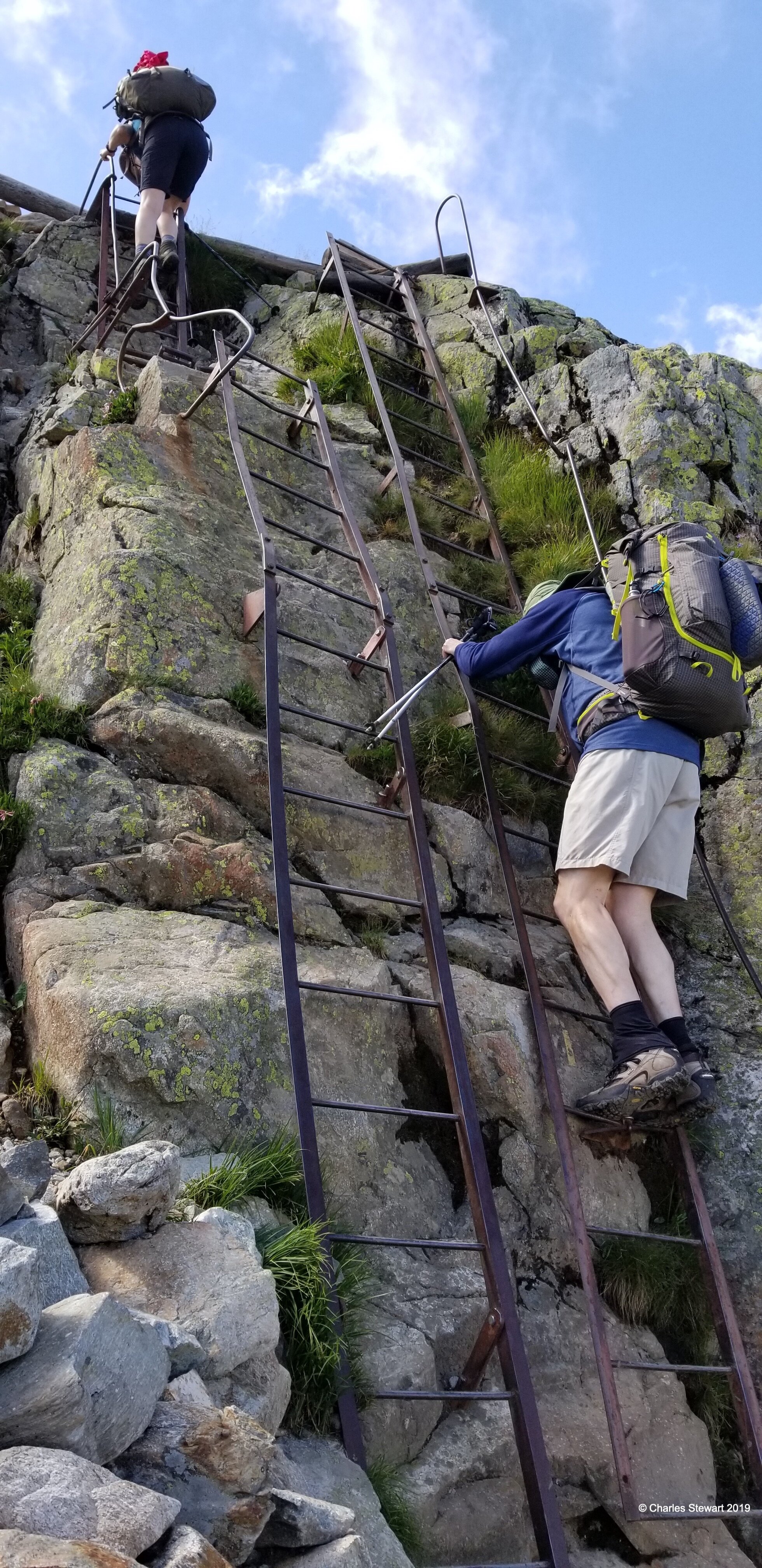
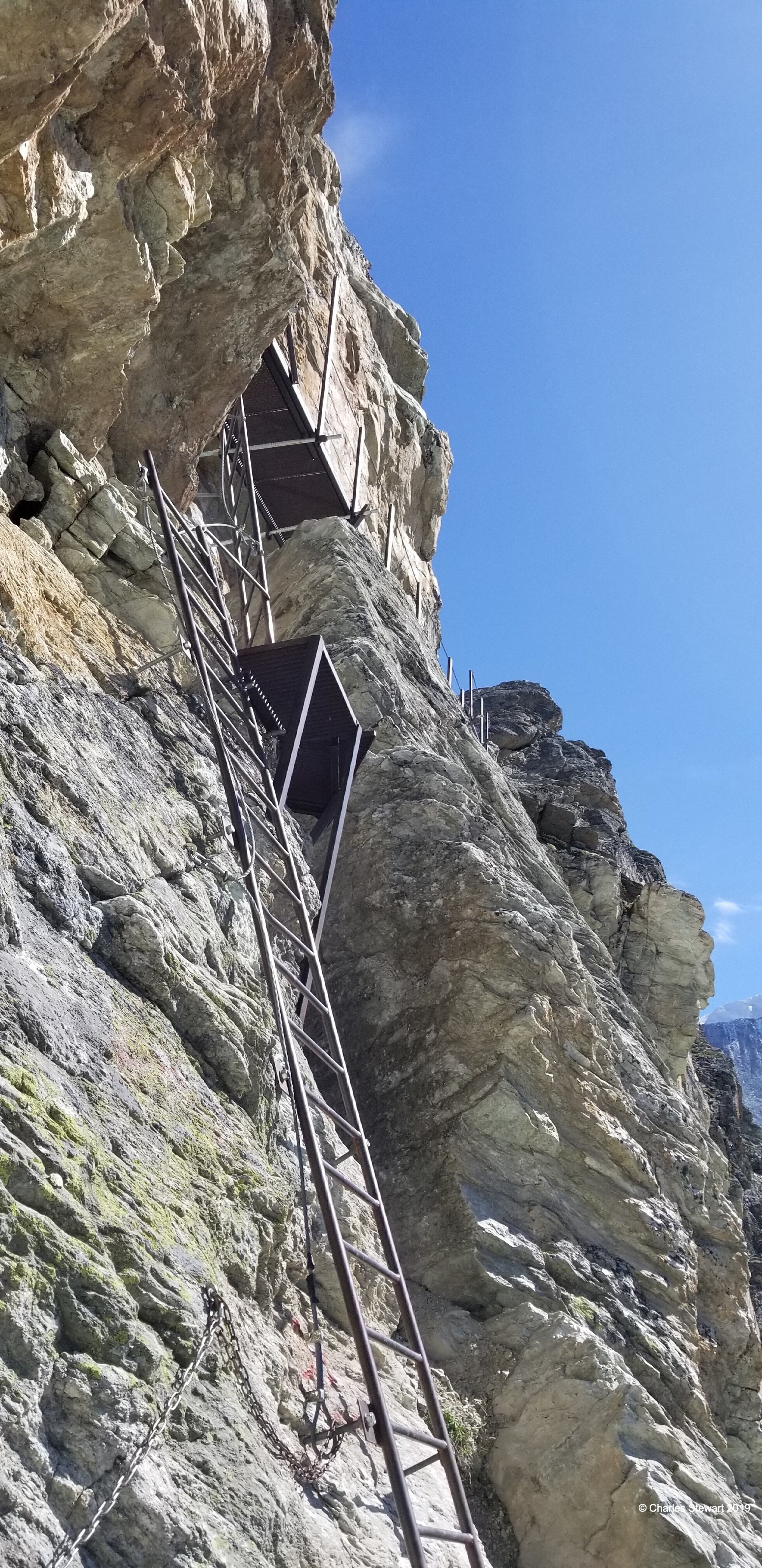
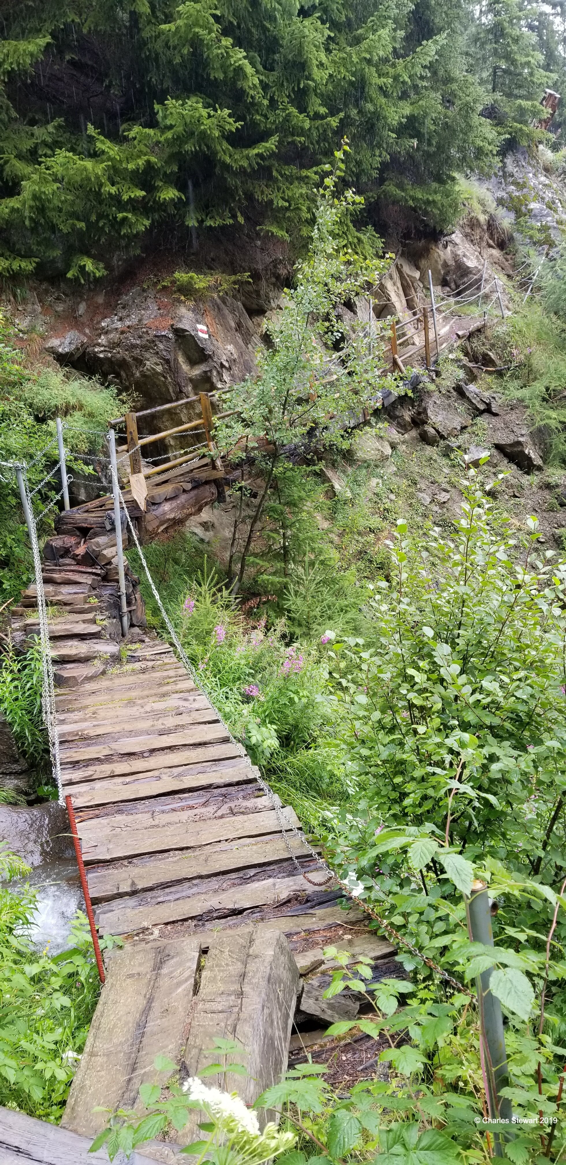
Underfoot you will experience a variety of tracks and trails on the Haute Route. Most mountainous sections run on single-track paths that can be rocky in places, sometimes with steps but mostly just the bare earth. Sometimes we will cross talus fields or slopes, and sometimes we will have areas with a large amount of scree. Mud is not a problem like it is on trails in NH in the spring. Sometimes, travel is along gravel forest roads, ski pistes, or rough tracks for vehicles over agricultural land. There are some sections of country lanes. Unusually even for an Alpine hikes at this level, some of the mountain passes are steep, loose and rocky, calling for good experience and steady balance. An alternative to one of these steep cols that we will take is a series of long, almost vertical, ladders. There are also some very short sections of glacier that must be crossed but these are near-flat and are usually unglaciated (in normal circumstances almost just a walk on snow).
IS THE ROUTE OBVIOUS?
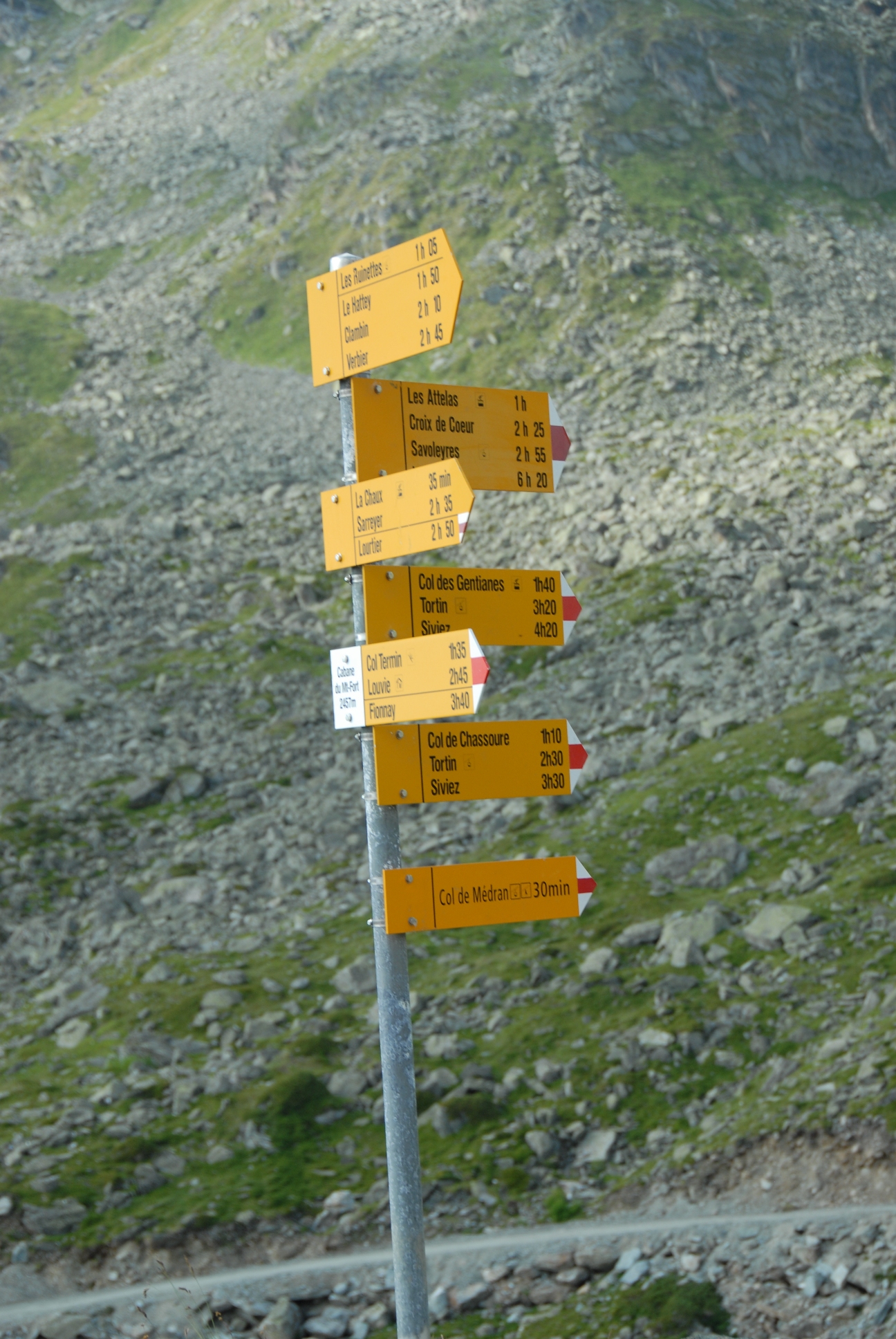
The Haute Route has sections that are particularly difficult to navigate, if the visibility is poor. Other sections are reasonably clear. It is crucial to note that there is no set 'Haute Route' trail; instead the route follows pre-existing paths and tracks. It's crucial therefore to have a guide that knows the way! The trickiest sections to navigate come on the rockiest and most remote terrain, where sometimes there are painted waymarks to follow but at other times a keen sense of direction is needed, allied to map and compass skills. We have the full route tracked on the GPS from doing it previous summers and always have that available as a reference.
During each summer season, snow falls on typically two or three or more occasions. It tends to go away equally quickly and tends not to be deep at the altitude of the Haute Route, but for the time it remains it can make navigation even more challenging. Under a cover of snow, ground features are hidden and reliance on map and compass skills is key.
It is essential for all parties on the Haute Route to have at least one competent navigator with a map and compass, for those situations where the route is not marked at a turning or where the clouds have closed in. The best maps for the route unfortunately still have mistakes, which comes as an additional hazard. This is a guided trip with an experienced guide, so we have that covered for you. While the route changes from time to time due to trail conditions or maintenance, we carry a full gps mapped route, and updated route cards that represent the trail conditions recorded at the beginning of the summer season by one of our agents.
IS IT TECHNICALLY DIFFICULT?
The Walker's Haute Route is first and foremost a hike, but it is important to note that it is at the top end of difficulty in terms of Alpine hiking. The difficulty of the terrain is often underestimated. There is no glacier walking except for two narrow glaciers that in normal circumstances can be treated merely as a snow patches, and there is no rock climbing. There are, however, some sections where the path crosses exceptionally rocky and steep ground or is narrow and precipitous. As mentioned above, there is a long near-vertical ladder section on the standard route to Arolla. This ladder has a nearby alternative that may be used in bad weather if the guide so decides, but this alternative is such a steep and loose climb to a col that it is hardly any simpler. Additionally, the hike finishes with the two-day Europaweg into Zermatt which presents hikers with loose hillsides, boulder fields, and navigational challenges. If you have questions about whether you may be able to complete this hike, please reach out to us to get a more detailed description of each day’s hiking or for more information about likely hazards on the trail.
We have taken 360 degree videos of highlights of almost every day on the Haute Route. In these videos, you can pan around in 360 degrees and see what the hike is like, both underfoot and in terms of scenery. You can see these videos on our YouTube channel here.
WEATHER
The typical summer's day in the Alps brings hot sun, perhaps with occasional rain or afternoon storms, but in any case paths that are clear of snow. However, fresh snowfalls occur each summer on a handful of occasions. Most often, these leave a coating of an inch or two on higher passes only, and they disappear in a day or two. However, sometimes the snow stays for longer periods and is deeper. While the Haute Route should be approached as a summer Alpine hike, with snow quite unlikely, it is wise to know that snow can fall even in summer
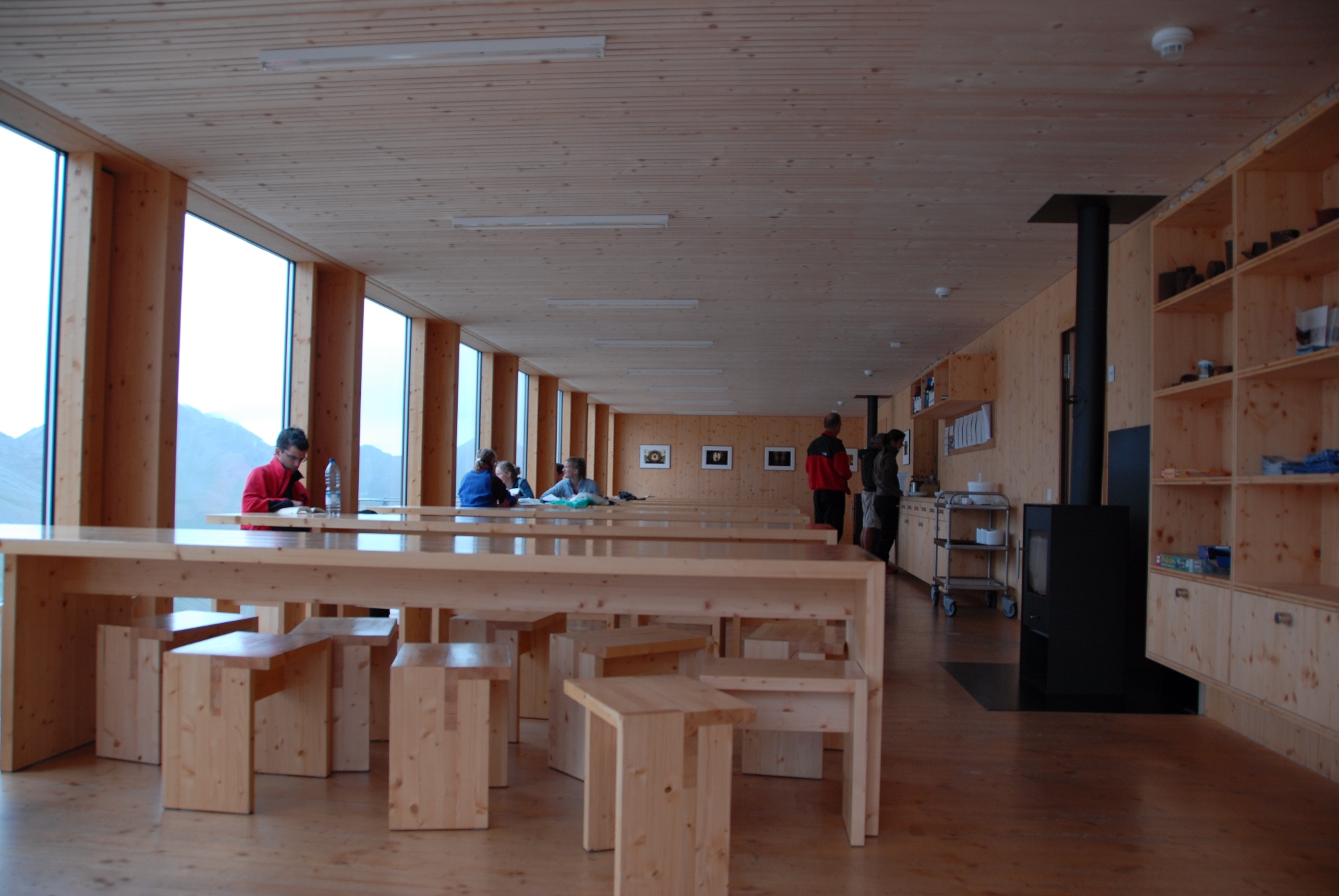
WHERE WE STAY
The Haute Route's accommodation is a major attraction of the route. For the 15 nights , we generally stay in:
4-star hotel (1)
3-star hotels (6)
2-star hotels (2)
Auberges (2)
Mountain huts (4)
Most accommodation is family run, even in the larger places such as Zinal. In Zermatt we book a superbly well-run yet not extravagant hotel, for a memorable finish.
ITINERARY
Travel day 7/24-5
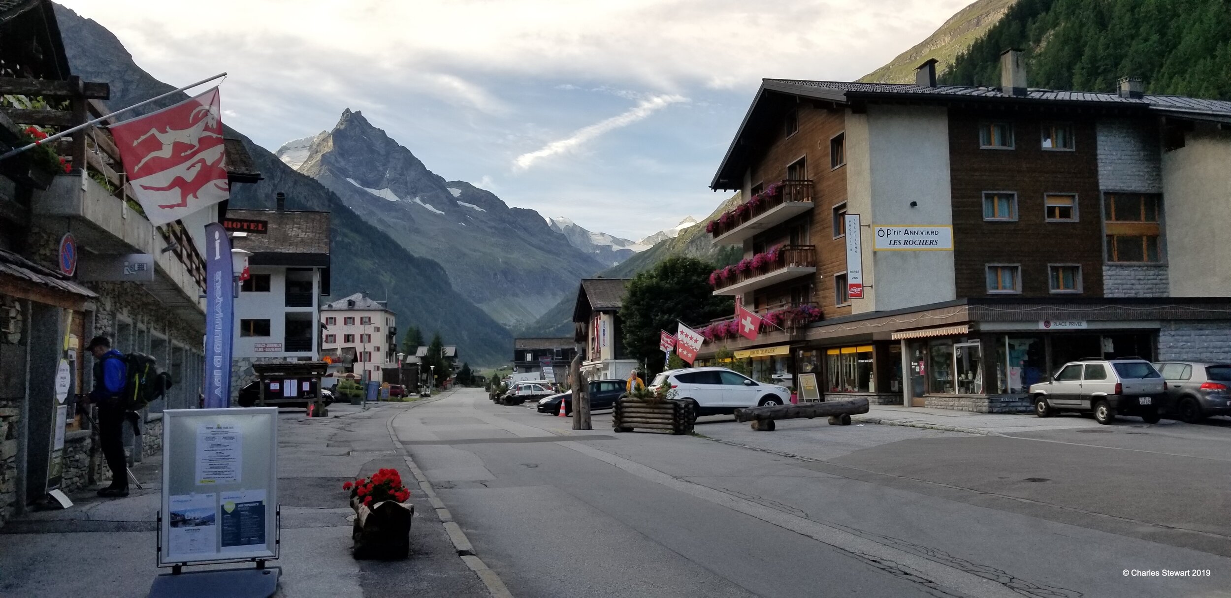
Flight from Boston to Geneva the evening of the 25th, arriving the morning of the 26. Train from Geneva to Chamonix where we spend the night in preparation of our journey. Welcome dinner in Chamonix.
Stage One 7/26
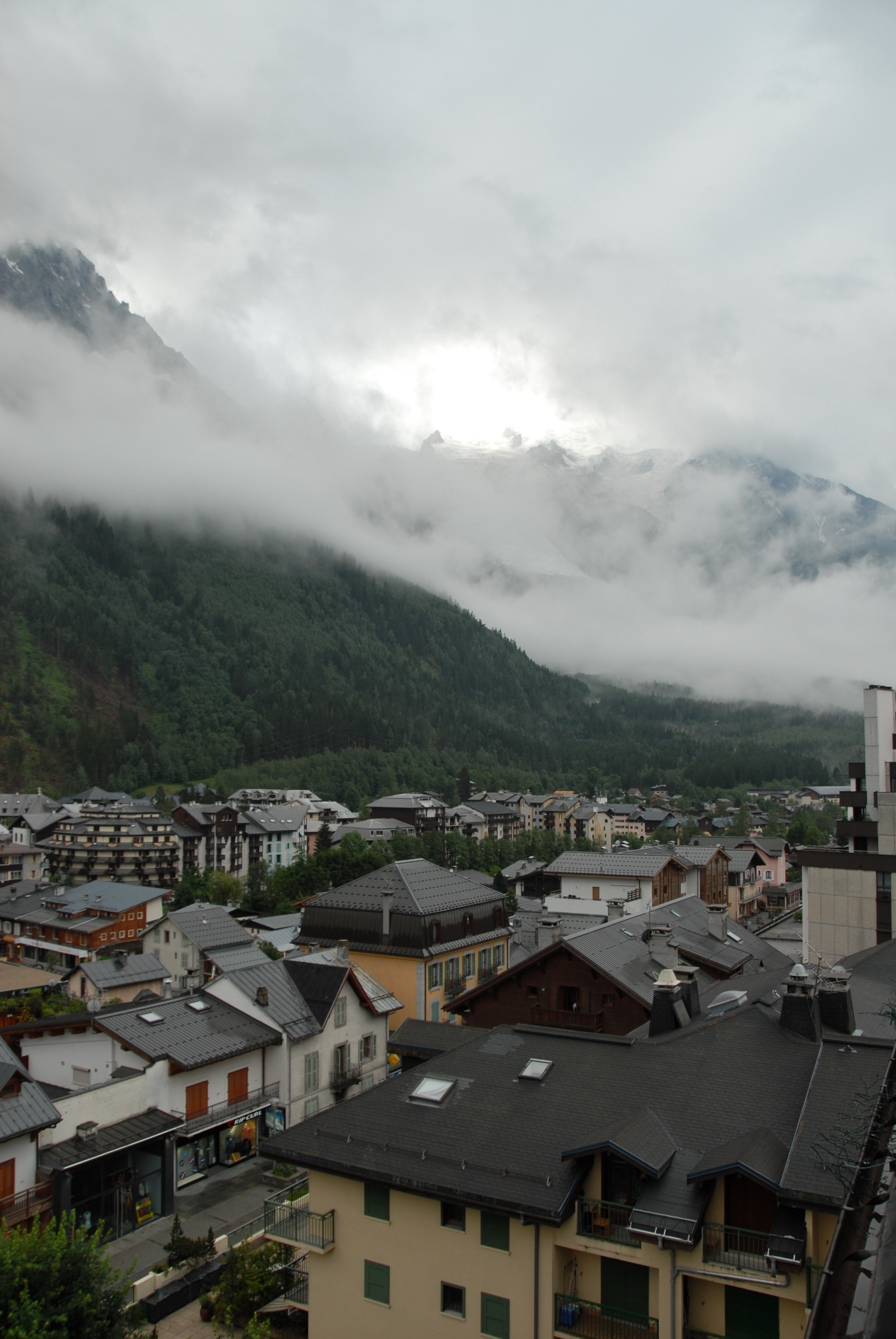
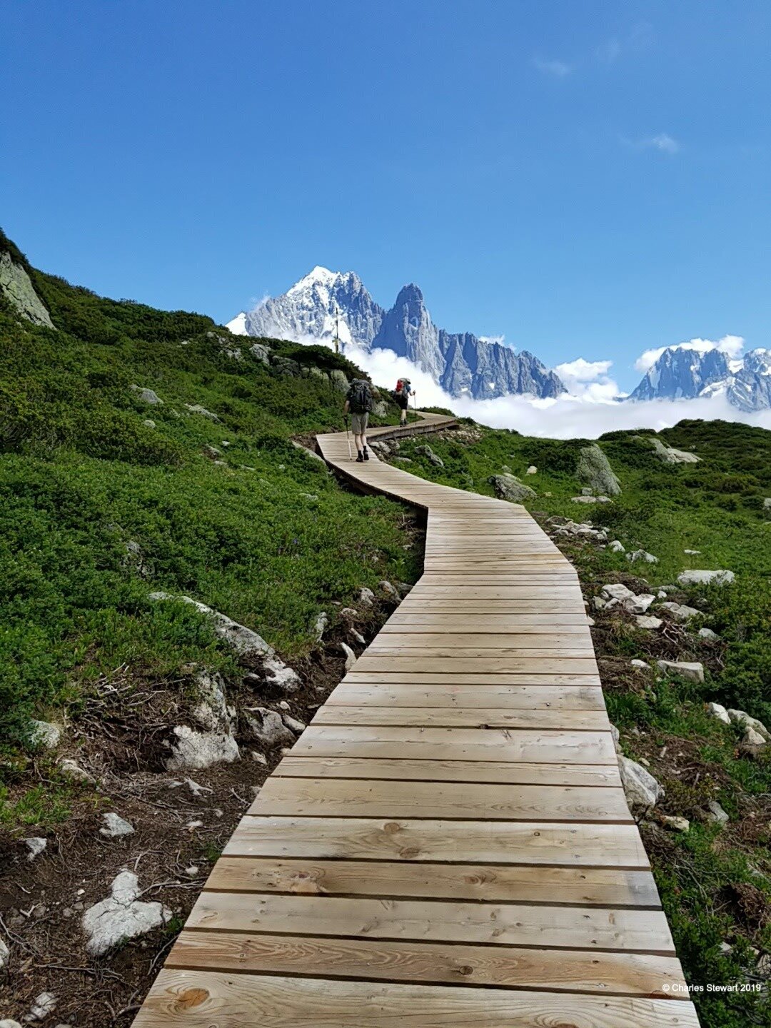
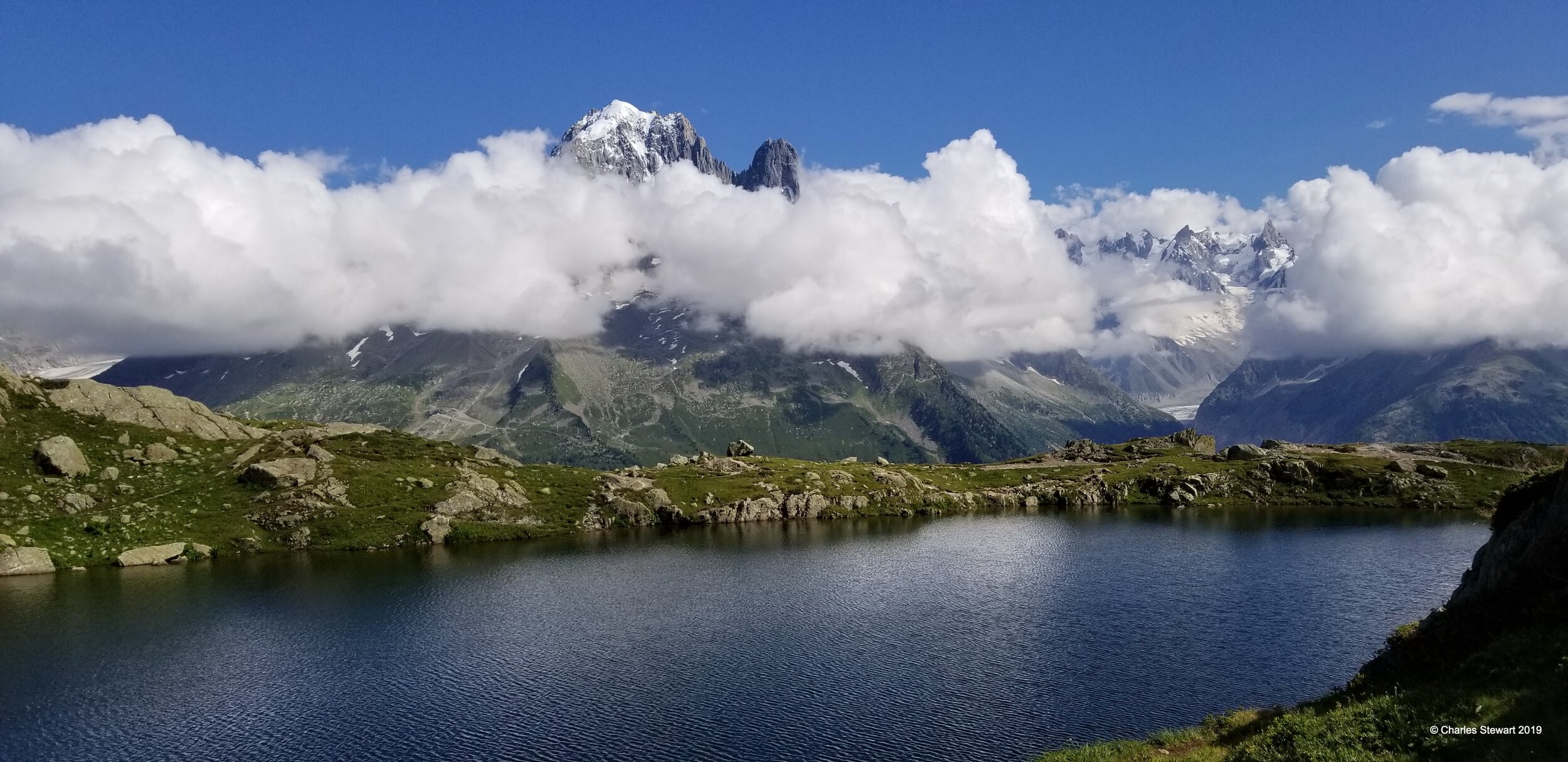
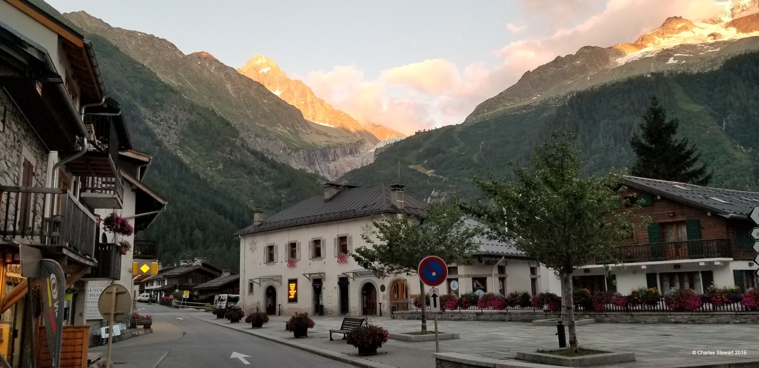
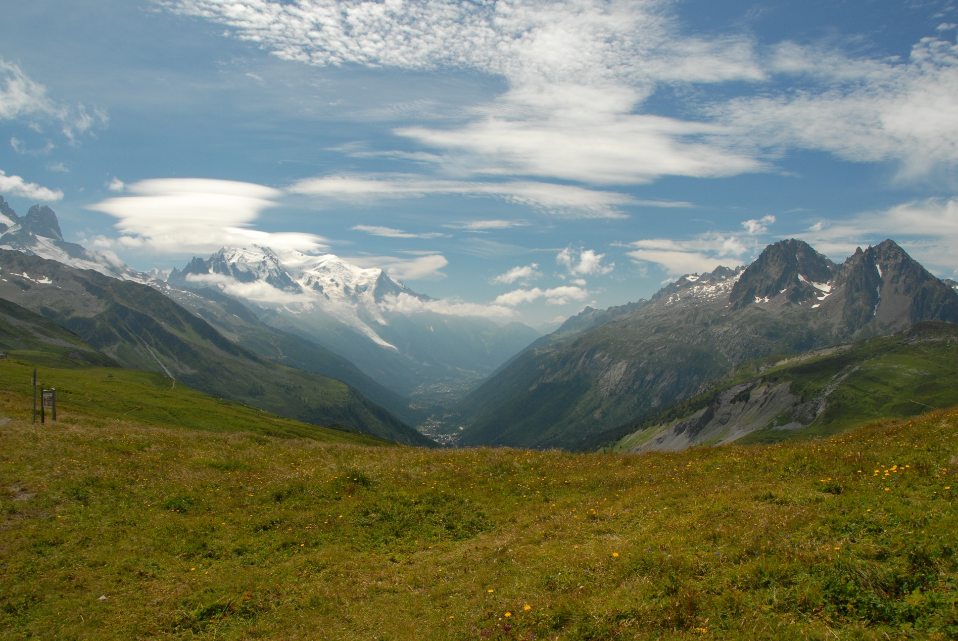
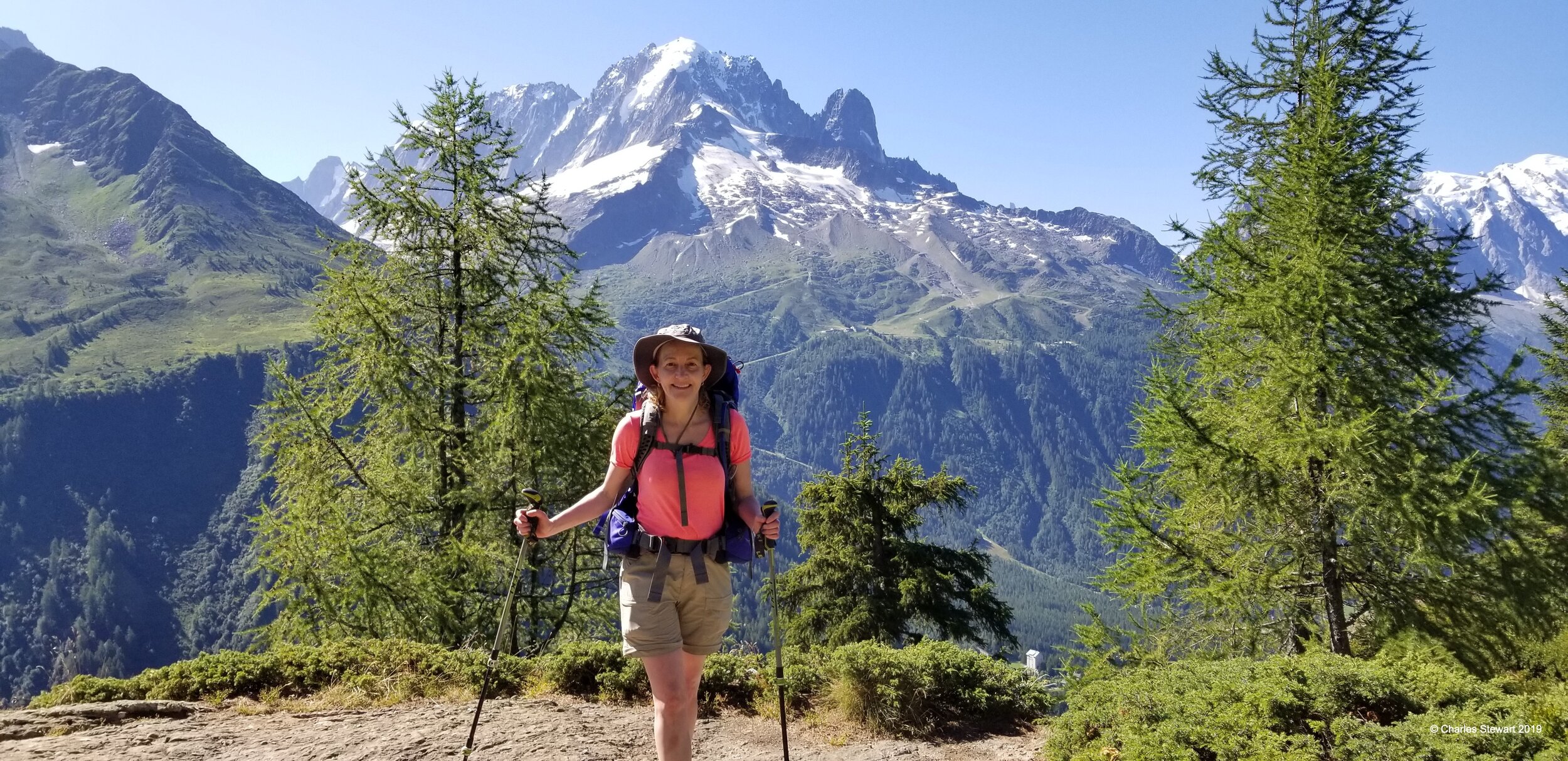
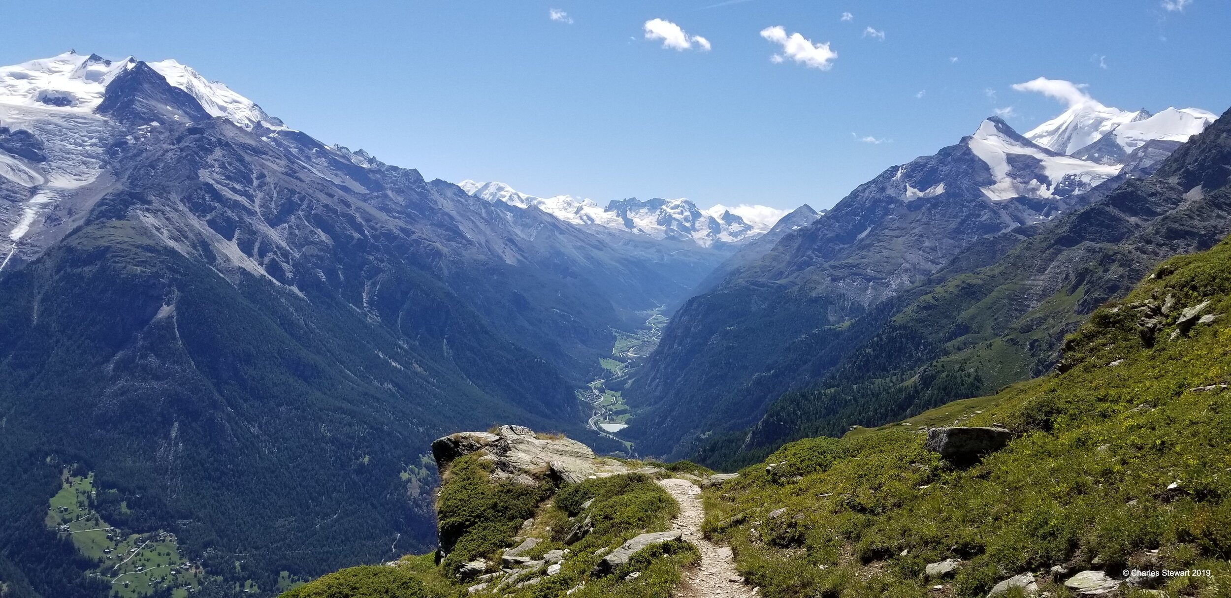
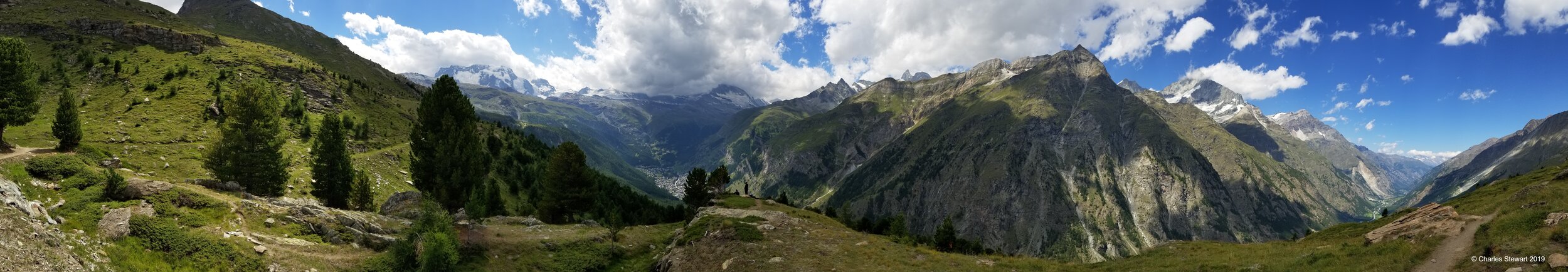
Start in Chamonix at about 1,000 m (3,281ft). Our route takes up the hillside across from Mont Blanc and we travel along the spectacular Grand Balcon Sud, to reach the beautiful mountain lake Lac Blanc at 2,352 m (7,717ft. ). The route then descends steeply to Argentiere which is the first day’s destination. Passing the L’aguille Rouge at a plateau around 2,200 m (7000 ft.), this route provides an appreciation of Chamonix valley from above before the Haute Route sets off into Switzerland the next day.
Stage Two 7/27
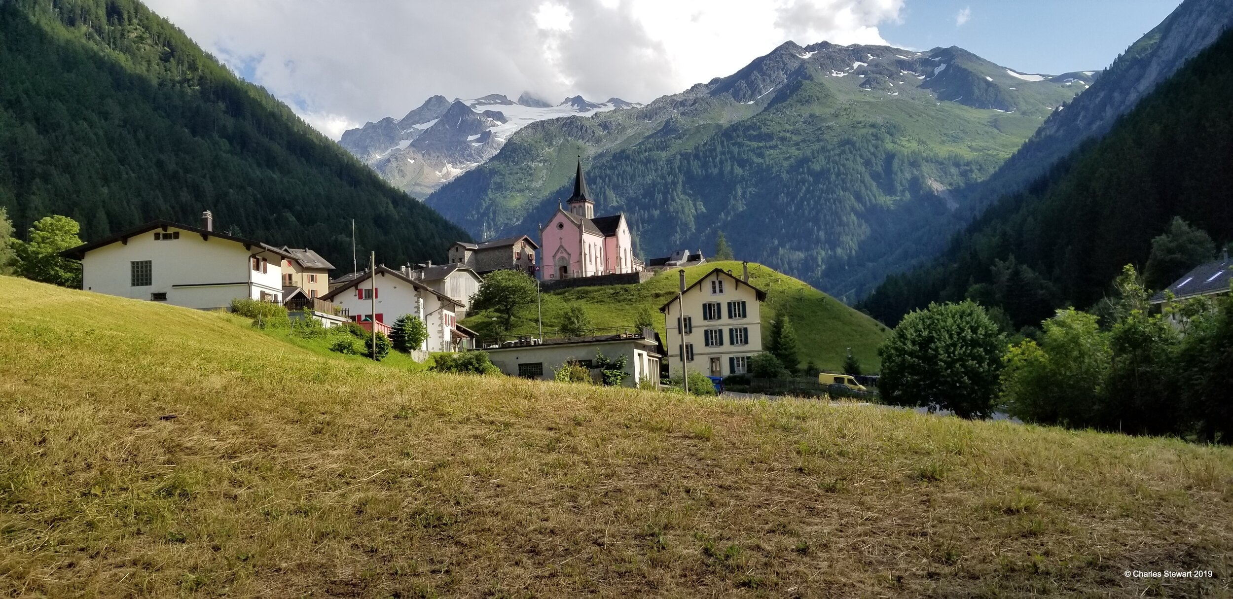
From Argentiere the Haute Route crosses the Col de Balme at 2,131 m (6,991ft). This is a gentle pass with grassy slopes rising up on the French side in what is a busy ski area in winter. Dropping down the far side, the path is steeper but this stage remains a moderate introduction to the Haute Route's theme of crossing cols. We drop through a deep larch forest into the hamlet of Trient for our first night in Switzerland.
Stage Three 7/28
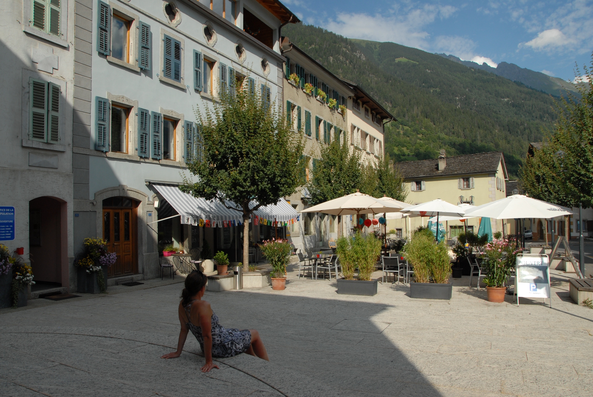
The next stage offers a choice of routes. Our route goes over the famous Fenetre d'Arpette at 2,665 m (8,743ft), or in bad weather, the alternative route via the alpage of Bovine at 1,987 m (6,519 m). Both routes are taxing, but the Fenetre (literally 'window') in the rock is an experience in the mountains to herald challenges yet to come. We end the day in the Swiss resort town of Champex, next to its emerald-green lake.
Stage Four 7/29
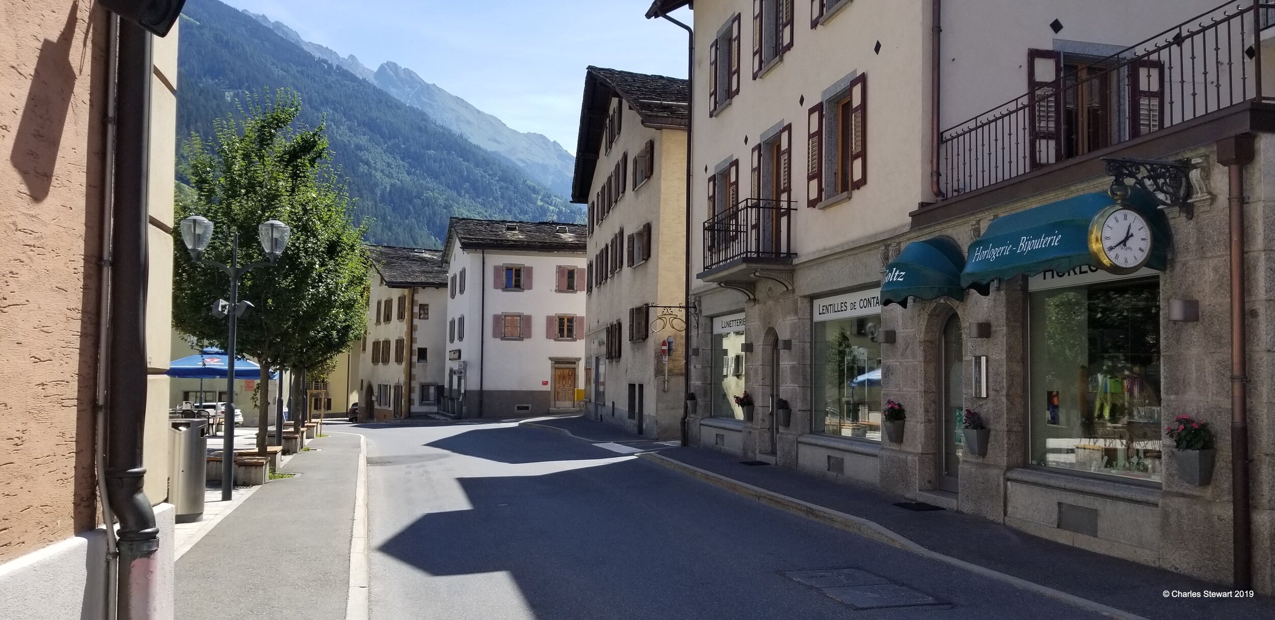
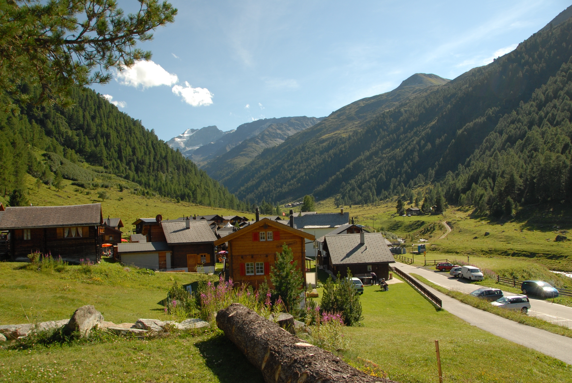
Today's destination is the working village of le Chable in the Val des Bagnes. This fourth stage comes as a contrast to the mountain routes so far. It's largely in the valley, first descending through woods and fields to Sembrancher where the railway from Martigny is met, and then crossing fields in the valley floor as far as le Chable. This is a chance to recharge before three hard stages all involving much ascent but often we arrive so early that hikers spend the afternoon taking the ski lifts up to the local ski areas and towns, perched on the sides of the surrounding mountains, for views they will see int he days to come.
Stage Five 7/30
Setting off from le Chable, settle in for 1,700 m (5,577ft) of ascent to the day's destination, Cabane du Mont Fort at 2,457 m (8,061ft). A steady rhythm sees the hillside chapels, wooded glades, tracks and paths pass quickly enough, all the time gaining height above the valley. In clear weather, Mont Blanc comes into sight. This is a stage of great transition, from everyday working rural Switzerland, to the edge of the high mountains.
Stage Six 7/31
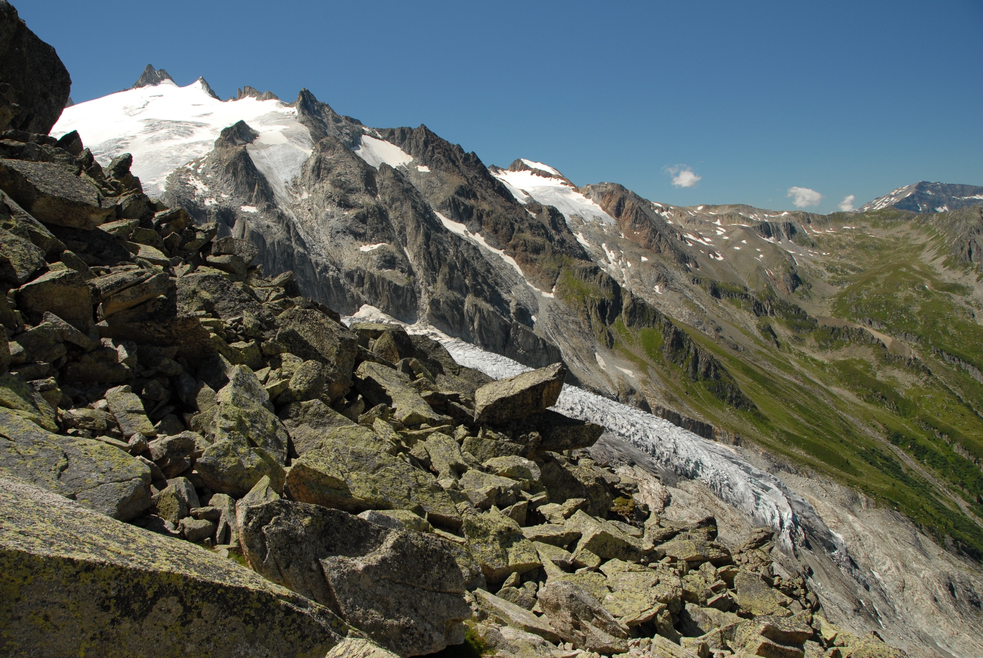
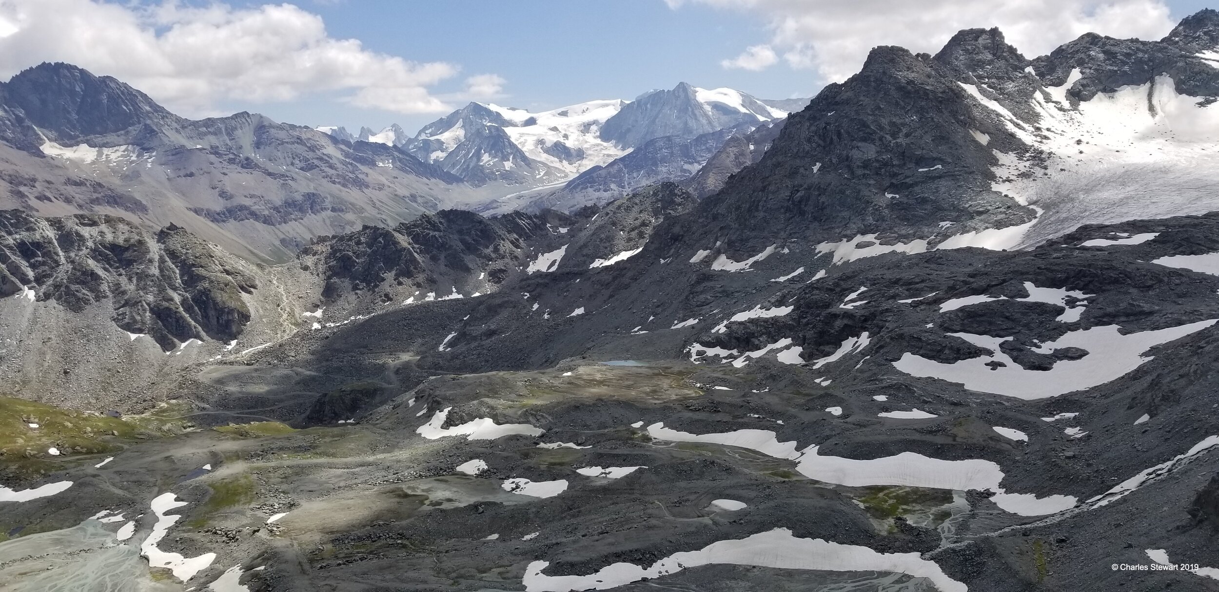
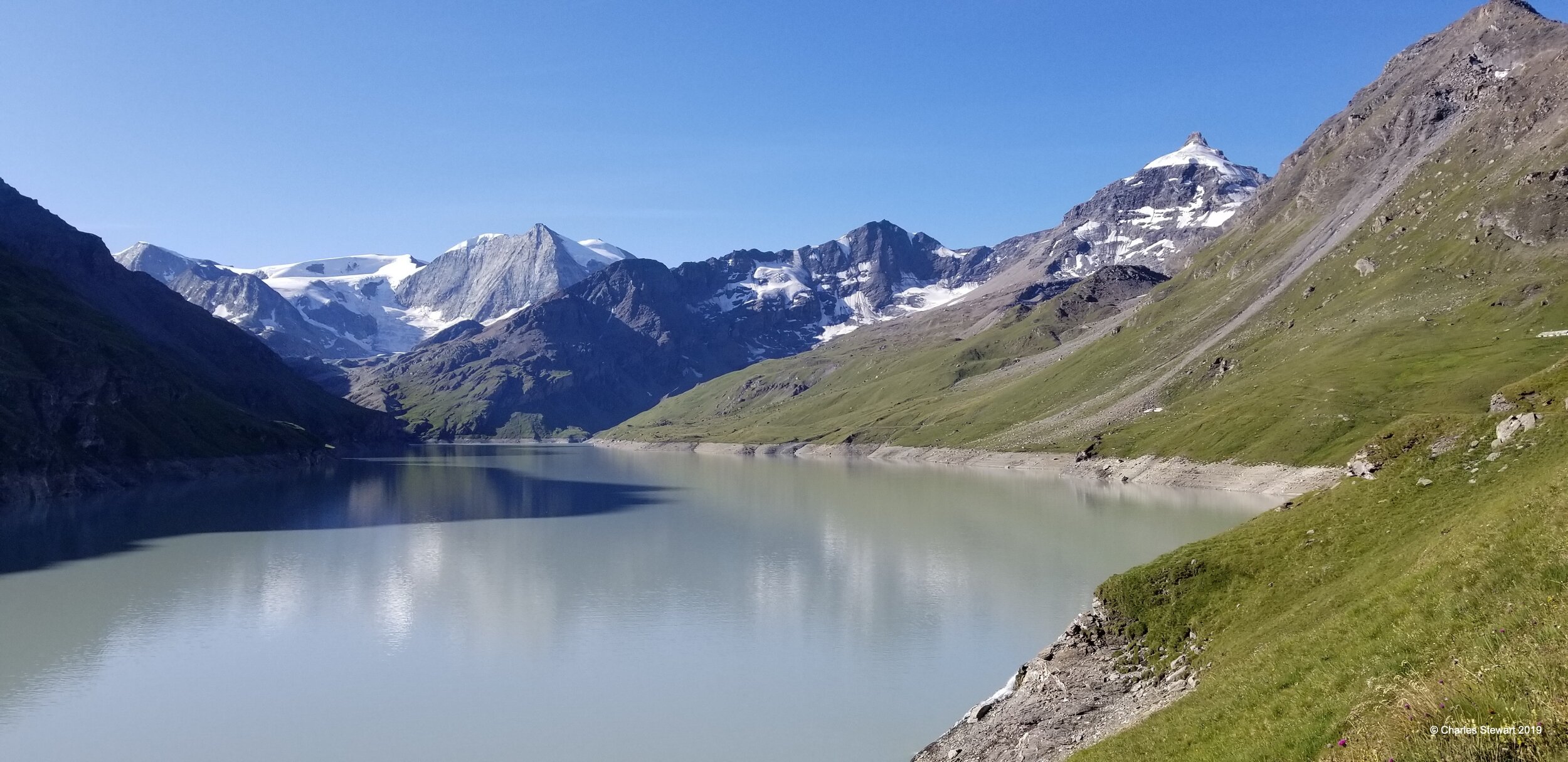
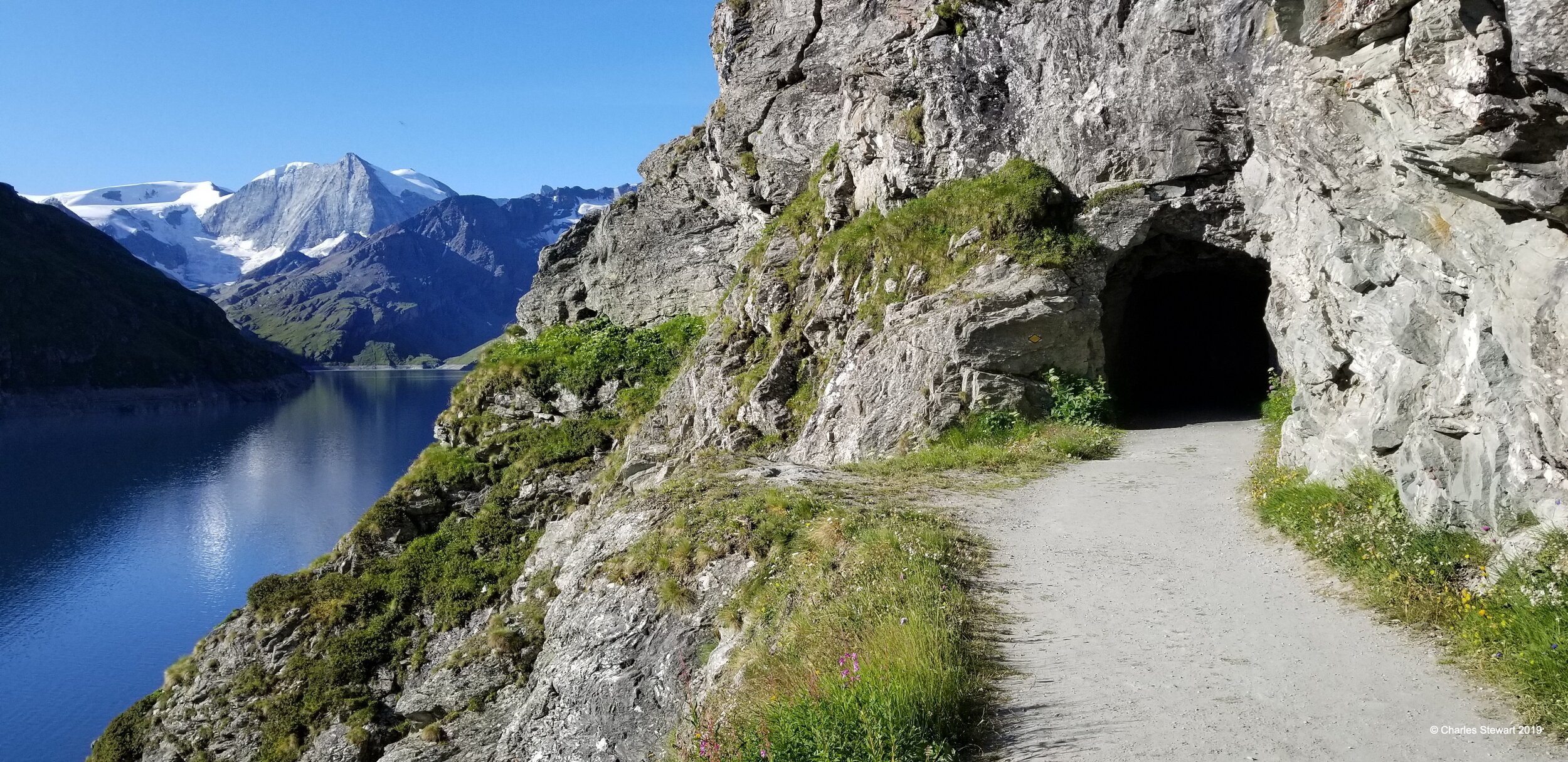
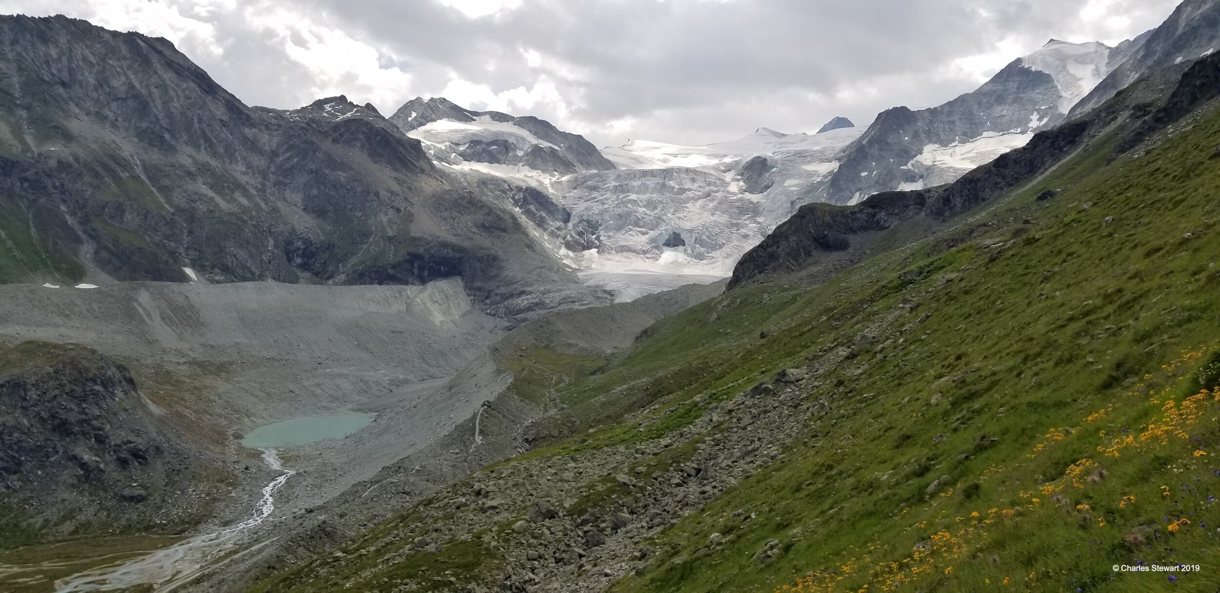
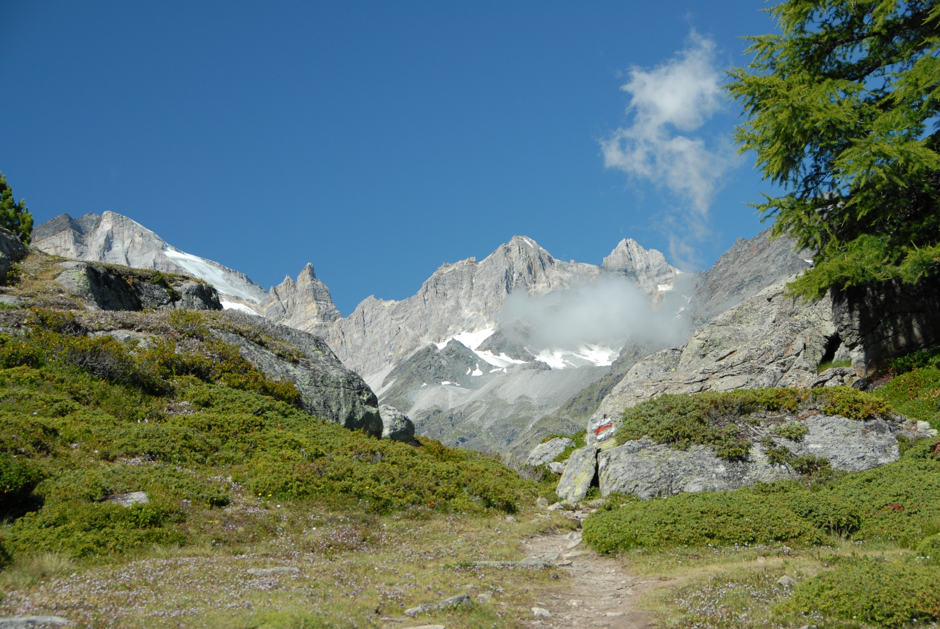
After a night at the Cabane in its grand setting rimmed by jagged rock peaks, it's time to leave for one of the Haute Route's most exacting stages. Any bad weather can make it a real challenge for even the most experienced groups. There are two routes available for the start of today’s journey; Col de la Chaux or Col Termin. Chaux is wild and rocky, while Termin is more amenable but longer, and both have a particular set of scenic views. This first col crossing complete, the route continues to two more cols: Col de la Louvie and then Col de Prafleuri at 2,987 m (9,800ft) which is one of the highest points reached on the Walker's Haute Route. A final drop to Cabane de Prafleuri completes this remote and rocky stage. Knees will be glad of the rest after the almost entirely pathless and often bouldery miles.
Stage Seven 8/1
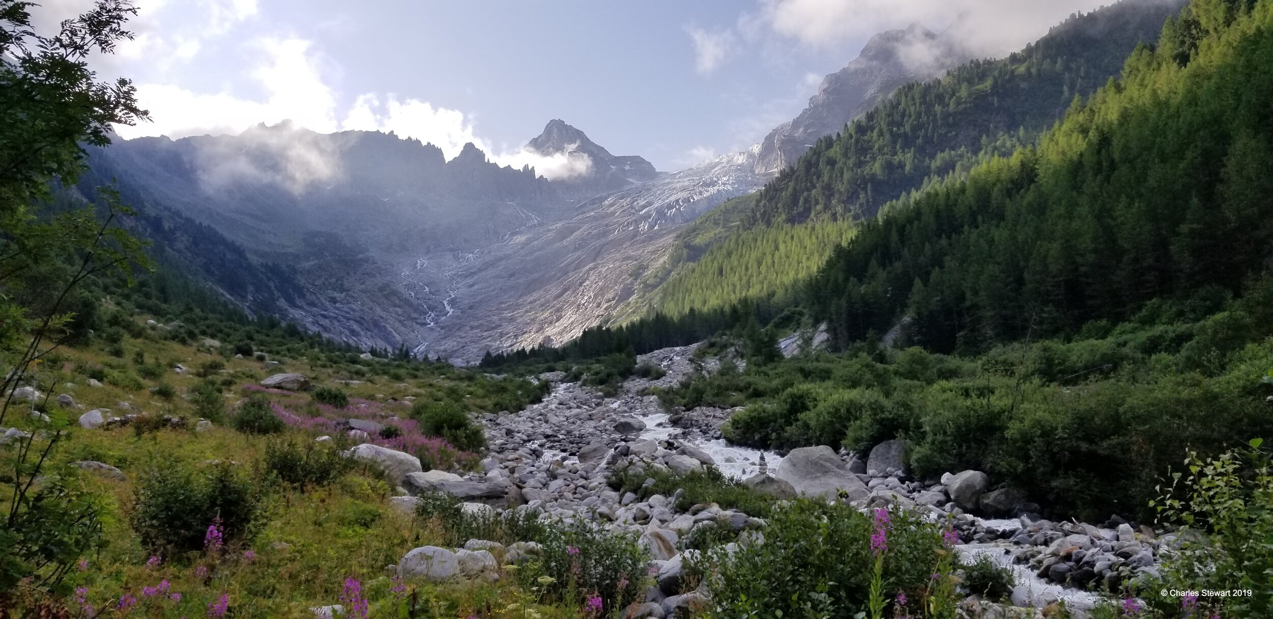
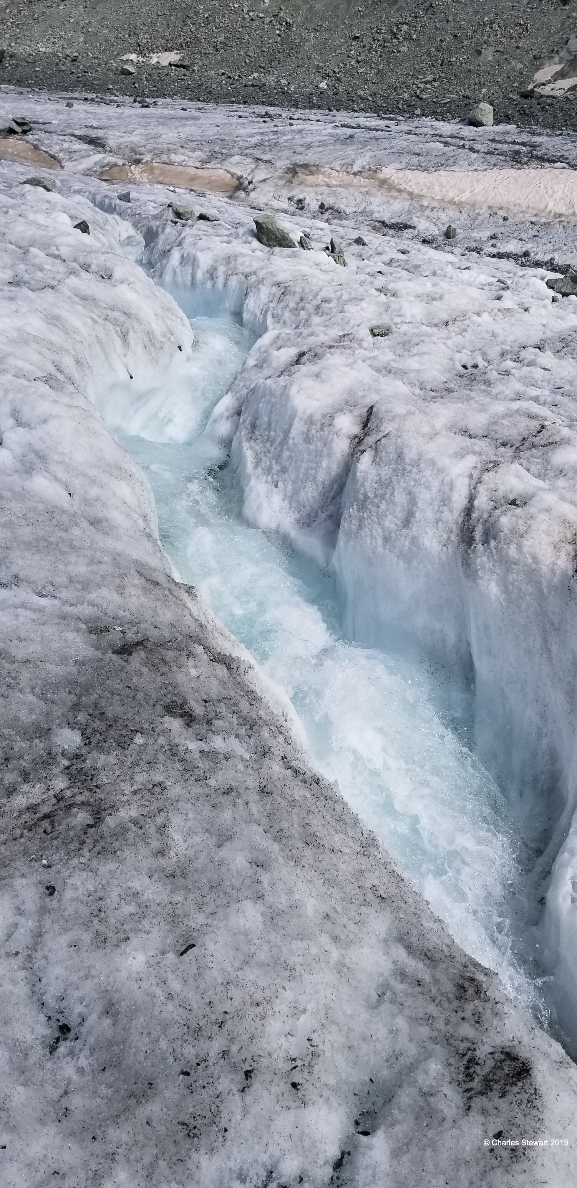
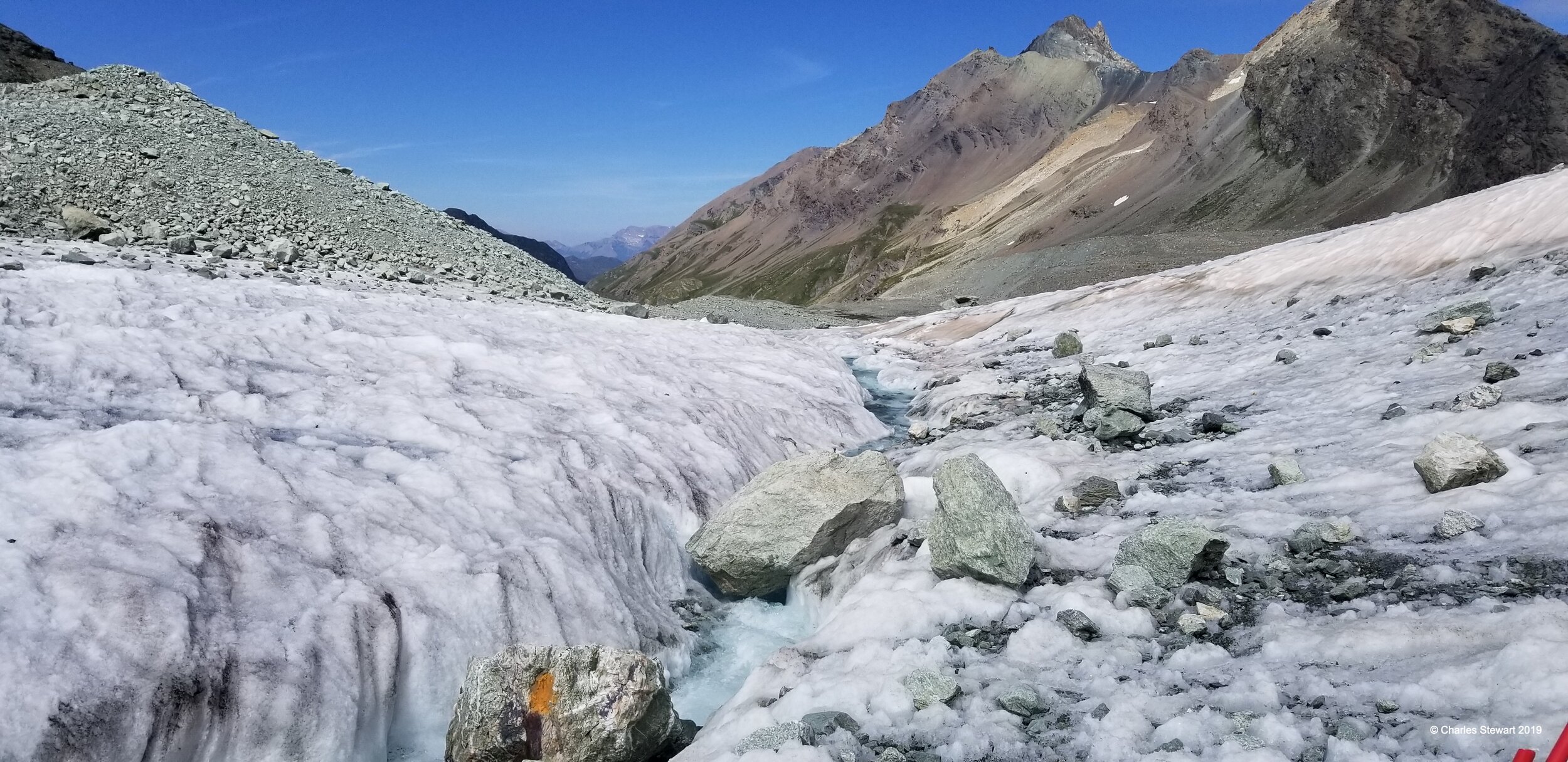
Possibly the hardest stage of the Haute Route comes today. This is the walk to Arolla. First we climb over Col des Roux to enter the grand basin of the Dix reservoir, an impressive setting. The route continues beyond the lake up to Cabane des Dix, a useful stopping point for lunch to break up this long stage. Again we are at just under 3,000 m (9,843ft) in altitude. A small glacier is crossed, that is often no more difficult than a snowpatch and that requires no special equipment, but is sometimes riddled n with rushing rivulets of melt water and fret with hazards, before a choice of two difficult cols is reached. There is the Pas de Chevres with its formidable near-vertical ladders, or Col de Riedmatten with its loose rocks and steep angle. After this section the roll down to Arolla is a breeze. The village is small but has all we need, at the head of Val d'Herens. This also happens to be the Swiss national Holiday, Swiss Day, so you can be sure there will be a celebration in Arolla this evening!
Stage Eight 8/2
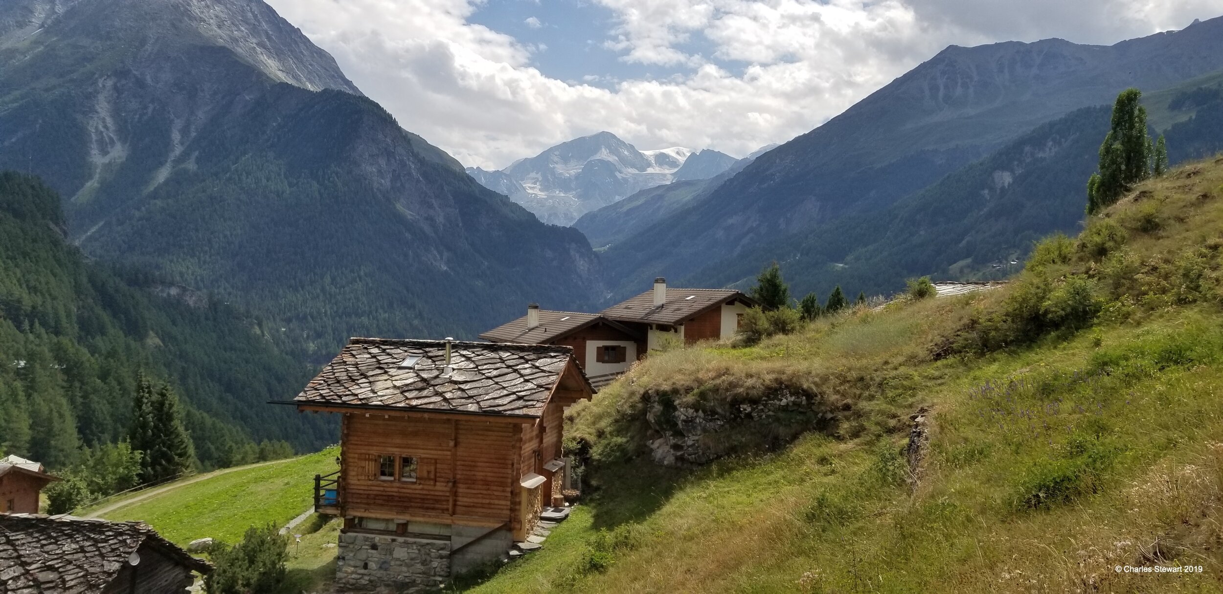
Three hard stages marking the crux of the Haute Route are over, so today is a welcome contrast. The walk down to Les Hauderes then up to La Sage is solidly in or just above the valley, on smooth trails and paths. It is also a relatively short distance, often arriving in La Sage before lunch. This gives us time to restock and relax or to explore the local culture. La Sage is a village typical of the Valais, our region here in the Swiss Alps, and it is one of our favorites with heavy stone flags for roofing and agriculture all around.
Stage Nine 8/3
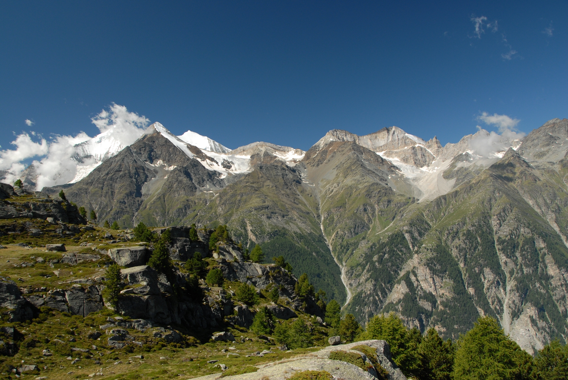
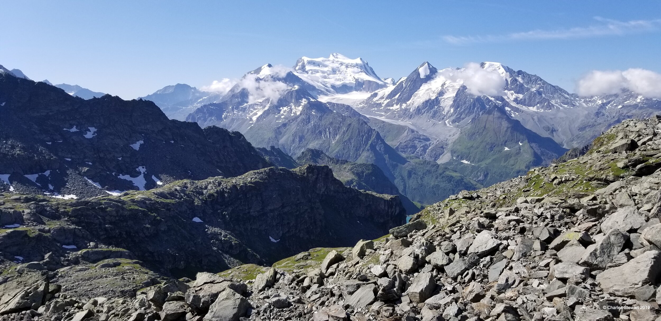
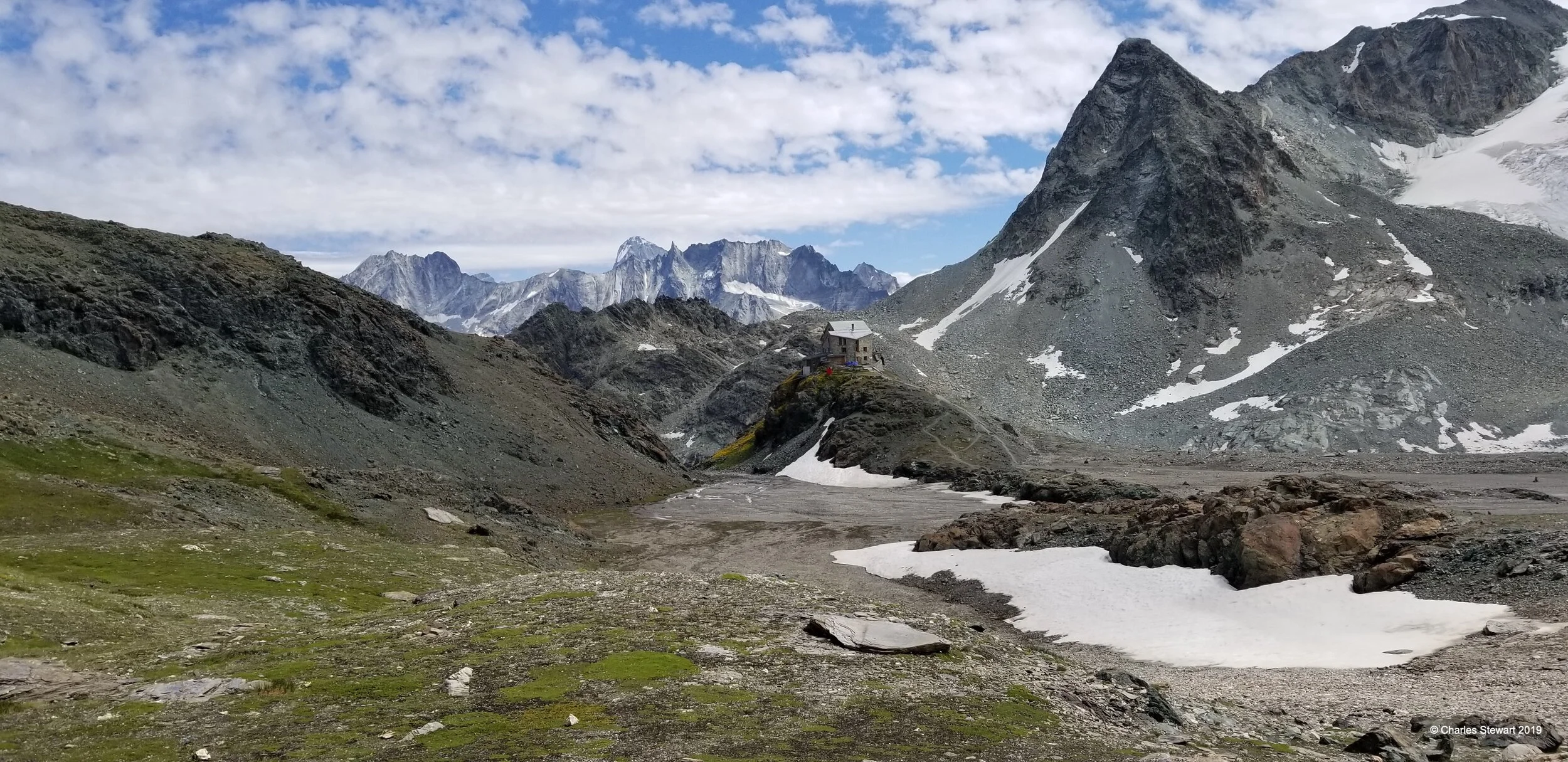
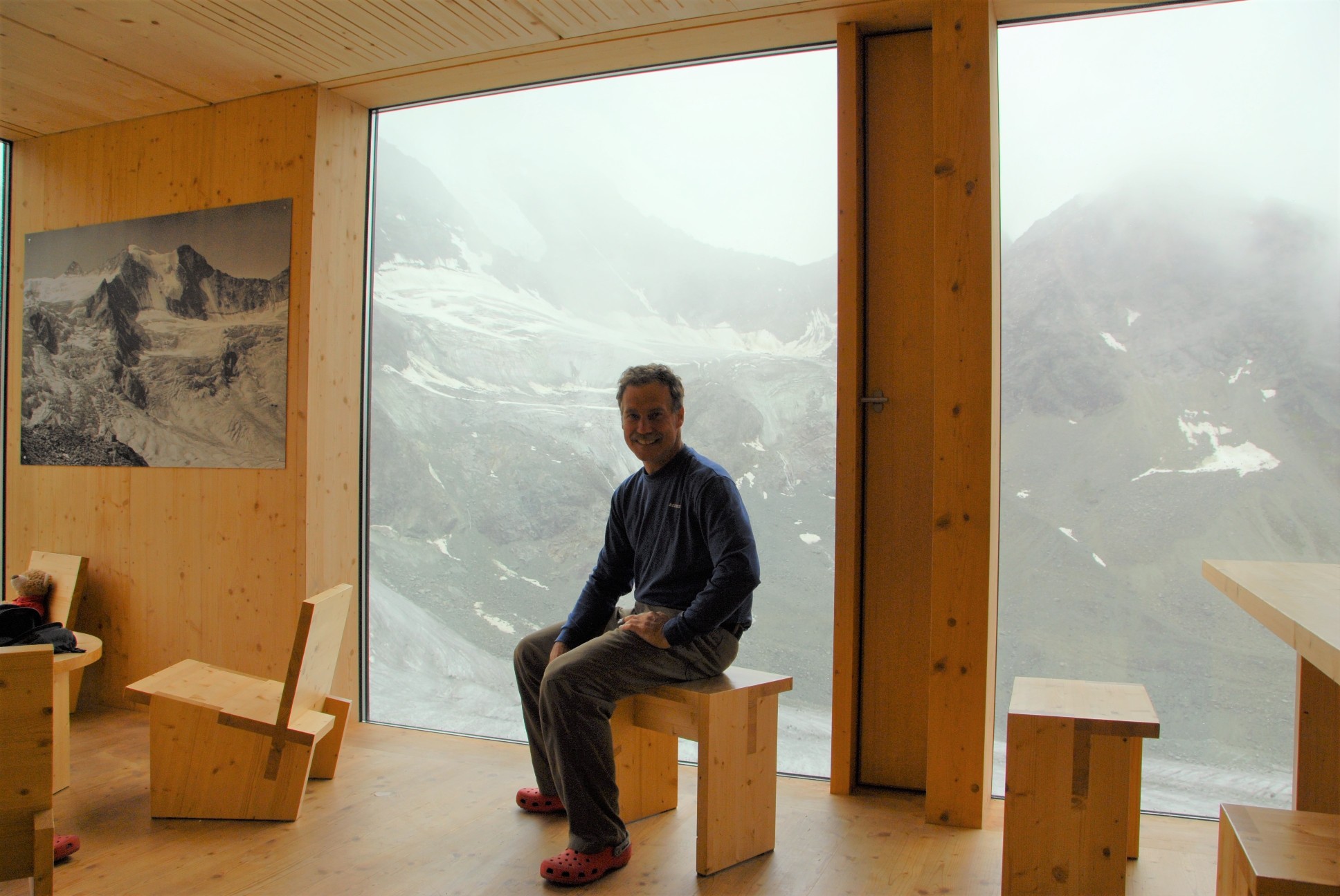
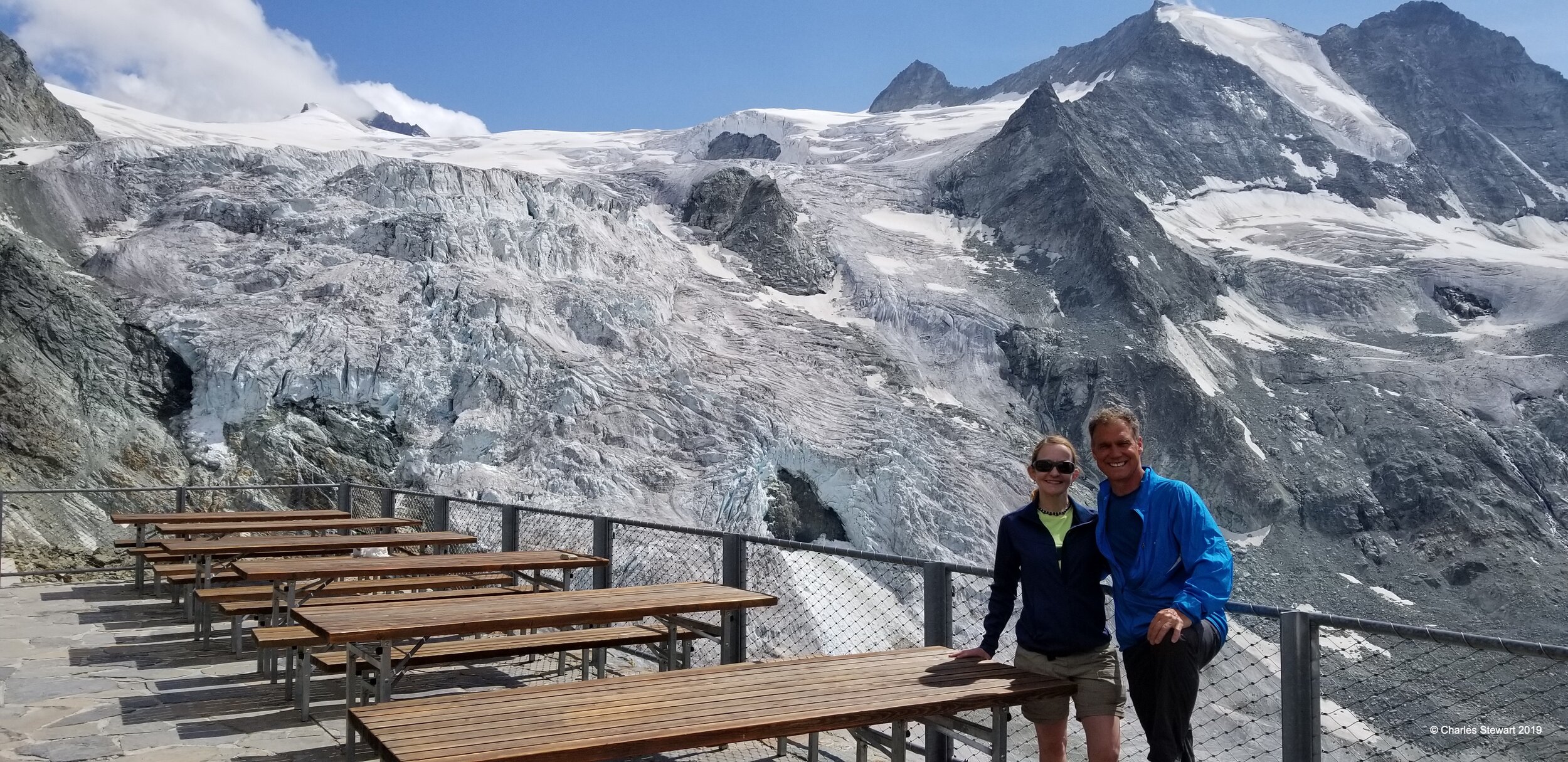
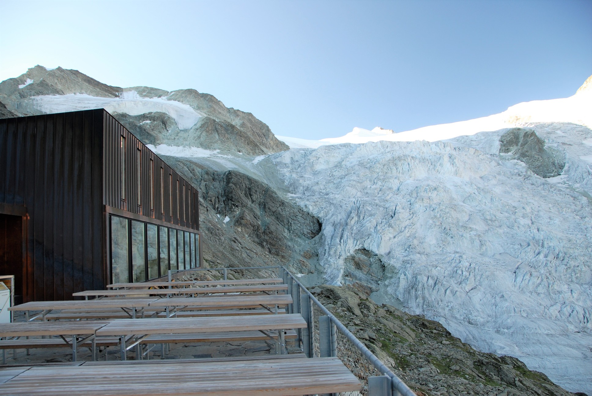
Once more into the mountains! Our route takes us over Col du Tsate at 2,868 m (9,409ft), to then descend to the Lac de Moiry basin before a second distinct climb to Cabane de Moiry. At 2,825m (9,268ft) this is the highest overnight stop on our route. We really feel like we are in the high peaks with the spectacular views of the glacier right outside the door of the cabane.
Stage Ten 8/4
From Cabane de Moiry the Haute Route retraces its steps a little, traverses high above Lac de Moiry, then climbs to Col de Sorebois. This col at 2,835 m (9,301ft) is grassy and easy compared to many others on the route! A long descent takes us down to the pleasant village of Zinal in one branch of Val d'Anniviers.
Stage Eleven 8/5
Taking one of two main routes, the next valley reached is the Turtmantal. We are into German-speaking Switzerland at the rocky ridge dividing Val d'Anniviers and the Turtmantal. From Zinal the route climbs to the Forcletta at 2,874 m (9,429ft), a rocky pass to new Alpine landscapes. High-mountain views abound from this point. The routes roll downhill to the small summer only village of Gruben where we spend the night.
Stage Twelve 8/6
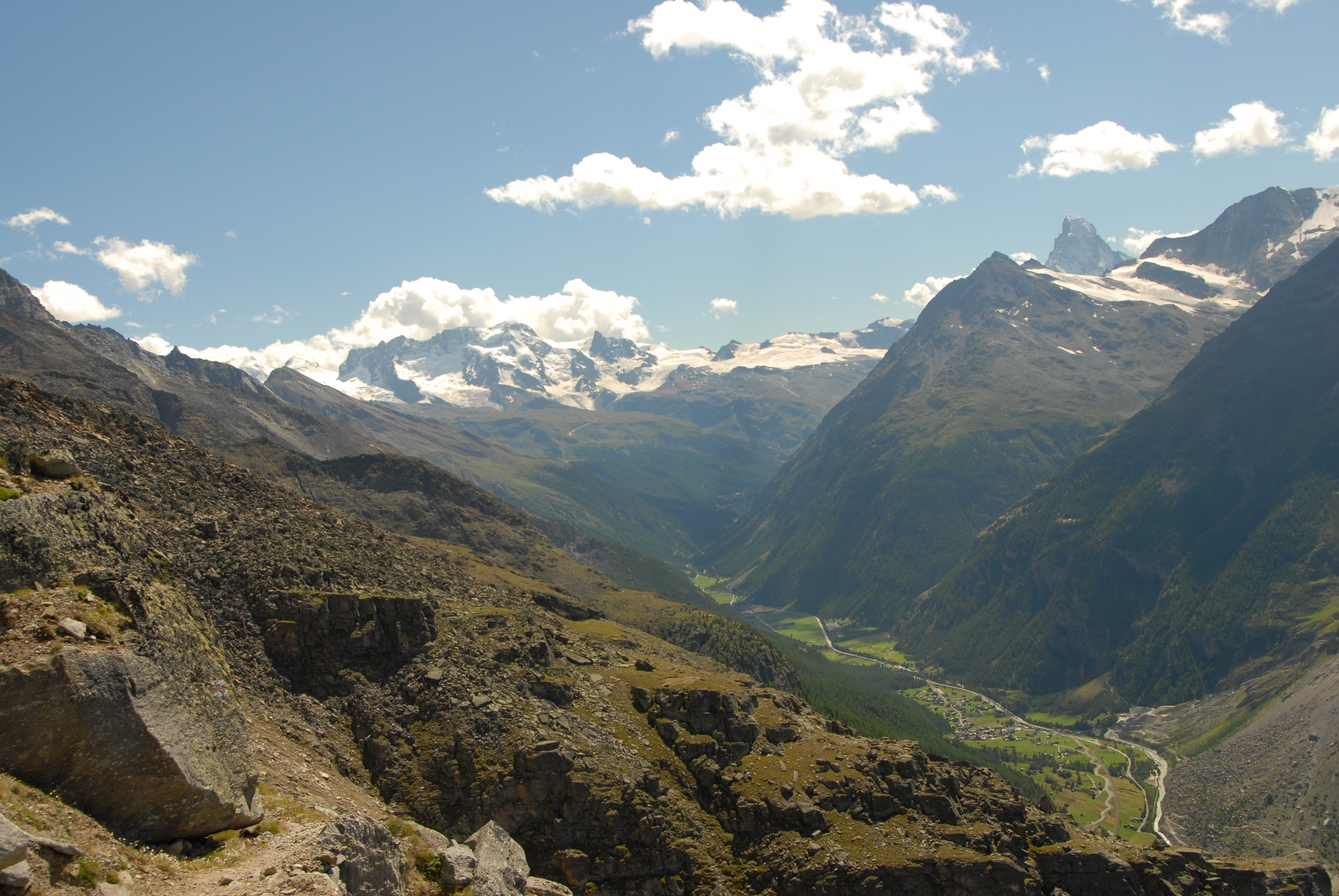
Today is the last stage with the Haute Route's classic up-then-down pattern. From Gruben we climb steadily to the rocky but wide Augstbordpass at 2,893 m (9,492ft). In descent, we enter the Mattertal valley which terminates at the far end with the Matterhorn. That said, the celebrated peak remains hidden by high mountain walls for this first day in the valley. After the high alp of Jungen with its barns and houses, the route zig-zags down to St Niklaus in the industrial part of the valley floor. We are in the final valley and just two days away from our final destination!
Stage Thirteen 8/7
Today we start the two-day finale into Zermatt, called the Europaweg. We reach the start of this path, via Grachen and Gasenried. Once up and on the Europaweg, the route crosses in and out of seemingly improbably rocky combes on a steep hillside. The Matterhorn comes into sight at the head of the valley. Late int he day, we rounding a spur we reach the wooden Europahutte at 2,265 m (7,431ft) and our home for the night. This hutte has a wonderful deck overlooking the valley with many of the highest peaks in Switzerland surrounding us.
Stage Fourteen 8/8
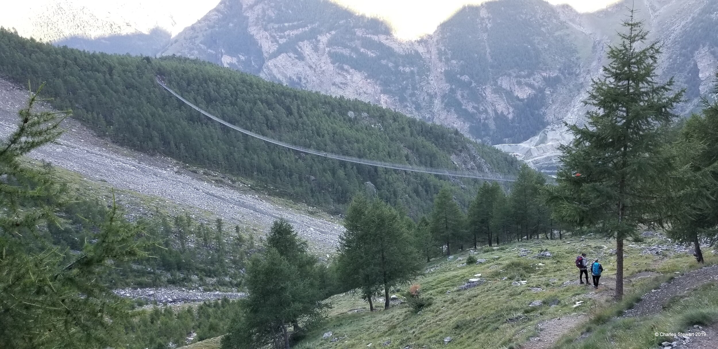
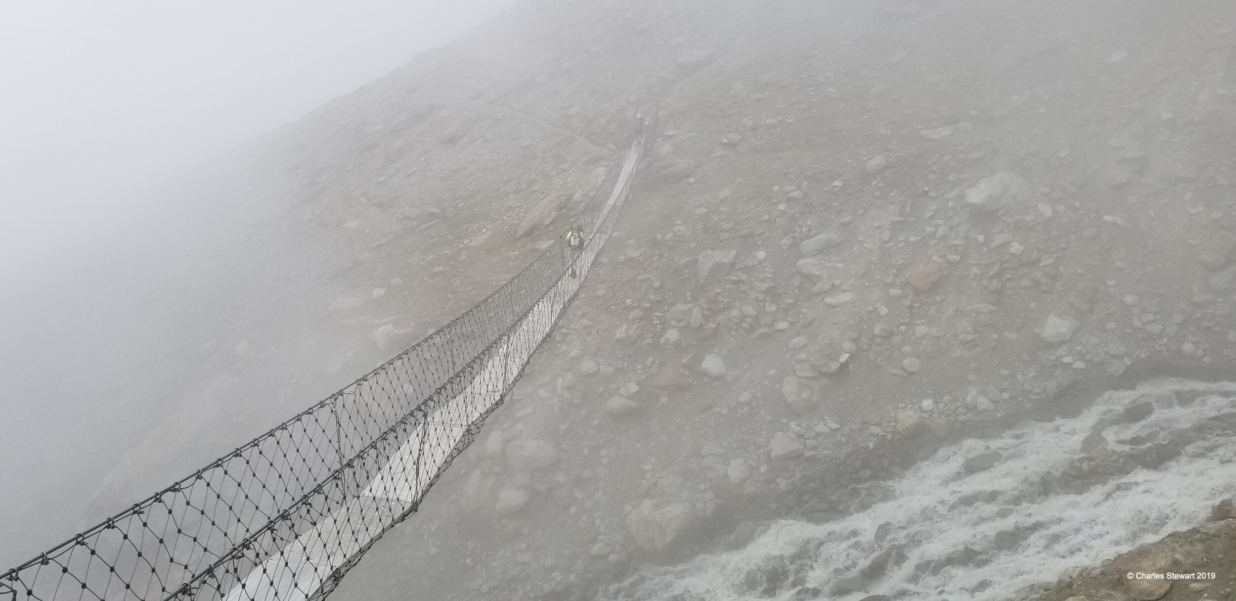
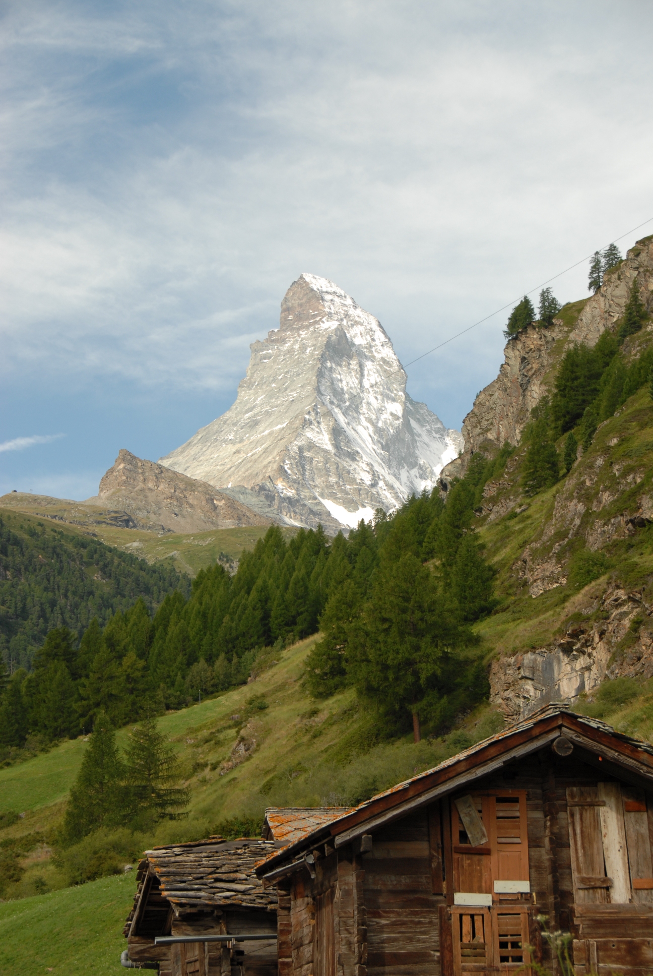
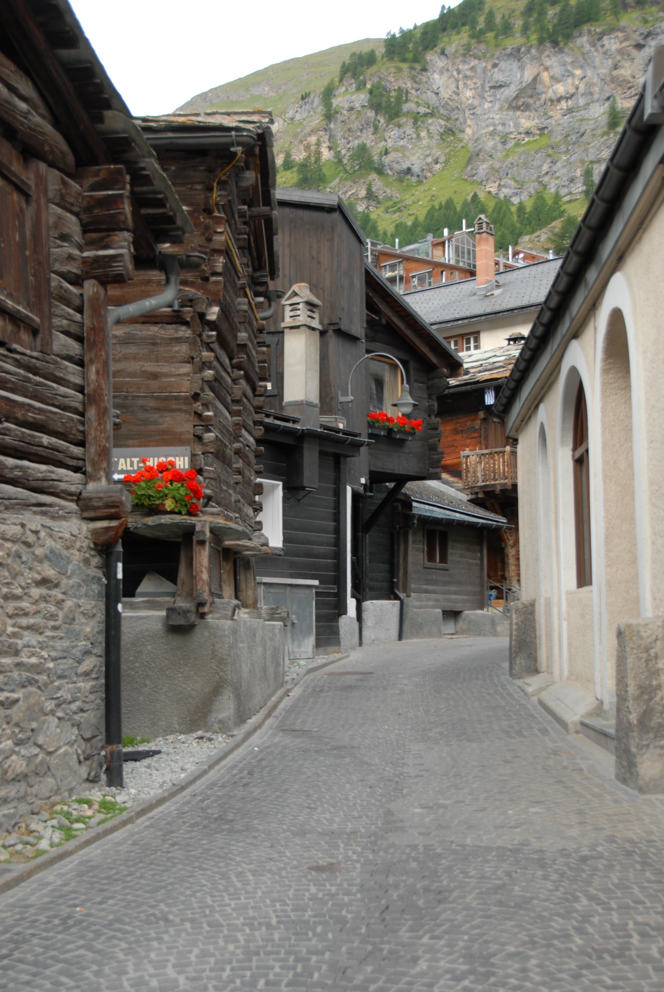
The trail continues from the hutte but within the hour crosses the Charles Kuonen suspension bridge which, at 494 meters (1620 ft.) in length, is the world’s longest pedestrian bridge. The Europaweg continues with today's initial sections retaining the characteristic challenge, but these challenges givie way steadily to easier walking as Zermatt gets closer. Tunnels and avalanche-protection walls are interesting features. Finally walking high above Zermatt, the full height difference with the Matterhorn's summit can be seen. A last descent passes barns and huts at Findeln brings us into town. The bustle of Zermatt brings no problems of adjustment, such is the magical nature of this car-free town.
Travel Day 8/9
With heavy heart, our two weeks in the mountains are over and we take the train from Zermatt to Zurich, then fly from Zurich to Boston.
PICTURES and VIDEO
For some pictures from previous hikes, Click Here. For 360 video from previous hikes, Click Here